| STATE |
WATERFALL NAME |
SCENIC
POTENTIAL |
TOWN |
NOTES & DESCRIPTION |
| MA |
Allen Brook Falls |
FAIR |
Greenfield |
rumored waterfall on Allen Brook; no other information known |
| MA |
Ashley Falls |
unknown |
Sheffield |
this is a waterfall on the Konkapot River and it is almost certainly located on PRIVATE PROPERTY; GPS = 42.053571, -73.335187 |
| MA |
Barre Falls / Barre Falls Dam |
POOR |
Barre |
this is a DAM on the East Branch of the Ware River |
| MA |
Bassett Brook Falls-South Branch |
unknown |
Adams |
this waterfall on the South Branch of Bassett Brook is also called "Silver Fox Falls" and "Falls on Bassett Brook" and "Cascades on Upper Bassett Brook #2"; may be visible from the Silver Fox Trail; Mt. Greylock area; I believe visiting both the falls on the South Branch and the falls on the North Branch (see entry below) require a total hike of 2.1 miles each way |
| MA |
Bassett Brook Falls-North Branch |
unknown |
Adams |
this waterfall on the North Branch of Bassett Brook may be beside or close to Old Adams Road; this waterfall is also known as "Cascades on Upper Bassett Brook #1"; "At a point where the trail makes a little zig from southwest to northwest, I looked down into a steep ravine to see another impressive falls"; Mt. Greylock area |
| MA |
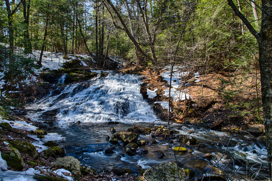
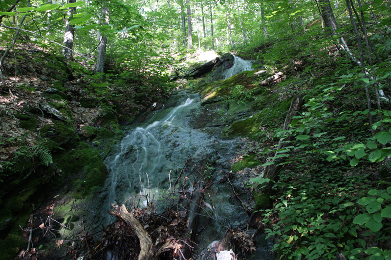
Bear Hole Falls
(picture)  |
FAIR |
West Springfield |
this is a small waterfall on Paucatuck Brook; located within the "Bear Hole Reservoir", which seems like it may have become a conservation property in 2015 or 2016; access is likely be via Bear Hole Road (Bear Hole Road is off Dewey Street) or Great Plains Road; good information can be found here > https://chasingwaterfallsinnewengland.wordpress.com/2015/06/01/bear-hole-reservoir/ |
| MA |
Beaver Brook Falls |
POOR |
Dracut |
this is a DAM on Beaver Brook; GPS = 42.668720, -71.328928 |
| MA |
Becket Gorge Falls |
FAIR |
Becket |
these falls on Shaker Mill Brook are located on PRIVATE PROPERTY; you'll probably want to skip this one, although I have heard reports that the owner(s) may allow you to visit the falls if you ask politely; also known as Becket Center Falls and Becket Ravine Falls |
| MA |
Brigham Falls |
POOR |
Hubbardston |
these falls looked unimpressive per (now defunct) massfalls.com; there is a good chance these falls are actually a DAM; I tried to search for more information about these falls in 2017 but came up short |
| MA |
Canada Falls |
GOOD |
Sunderland |
these falls are located on PRIVATE PROPERTY; there is no public access at this time |
| MA |
Cascades in Cold River Gorge |
FAIR |
Drury |
these are two cascades on the Cold River within this gorge; the falls can both supposedly be viewed from roadside (MA 2); the parking area for the lower falls is near where MA 2 passes Black Brook Road; the upper falls are about 1.0 mile further (west?) on MA 2 |
| MA |
Cascades, The (Gill) |
unknown |
Gill |
these on Cascade Brook falls are most likely located on PRIVATE PROPERTY; Cascade Brook flows into the Fall River near South Cross Road; Google Maps pegs the location at these coordinates, but I'm not sure if that's correct or not = 42.620362, -72.545376 |
| MA |
Chesterfield Gorge |
POOR |
Chesterfield |
this gorge on the East Branch of the Westfield River is very impressive (perhaps MA's most impressive), but there are only extremely tiny cascades and rapids here |
| MA |
Chicopee Falls |
POOR |
Chicopee |
this is a DAM on the Chicopee River below the Deady Memorial Bridge on MA 141 |
| MA |
Clear Falls |
unknown |
Easthampton |
this appears to be a small set of cascades on the North Branch of the Manhan River per this photo: https://www.alltravels.com/united-states/massachusetts/loudville/photos/current-photo-12376260; also known as Manhan Falls; I suspect the falls are below a DAM; perhaps this is the spot? GPS = 42.287703, -72.736192; these falls may be on PRIVATE PROPERTY; there is a small chance that this is the same place as Loudville Falls, although Loudville seems like it is on a different water source |
| MA |
Cohasse Falls |
unknown |
Southbridge |
this is a rumored waterfall on Cohasse Brook, although there is a chance this is just a DAM |
| MA |
Danforth Falls |
FAIR |
Hudson |
this is a small waterfall on Danforth Brook; I am not sure if there is public access to these falls, although I can see on Google Maps there is some conservation land nearby; access is via a 0.3 mile hike that leaves a trailhead that has a steel gate on MA 85 about 1.0 mile north of junction of MA 85 and MA 62 |
| MA |
Dead Branch Falls |
unknown |
South Worthington |
this is a rumored waterfall on Dead Branch; you can see some whitewater on Google Maps for these falls (GPS = 42.341570, -72.825953), but I'm not sure how big or tall they are, or if there is public access or not |
| MA |
Dean Falls |
unknown |
Oakham |
these falls may be on PRIVATE PROPERTY; these falls are supposedly "located on Crawford Road at Lake Dean / Dean Pond" |
| MA |
Fall in East Windsor |
POOR |
Windsor |
I visited these 8-foot cascades on Alder Meadow Brook in 2009 and I was not impressed; there are thousands of uninspiring cascades like these throughout New England; easy roadside viewing from the intersection of River Road, Worthington Road and Old Route 9 |
| MA |
Falls along the Bellows Pipe Trail |
GREAT |
Adams |
this is a series of impressive but somewhat seasonal cascades on the east side of Mt. Greylock; I believe most if not all of hte falls are off the Bellows Pipe Trail; also known as Bellows Pipe Falls; a moderately difficult hike of 1.5-1.75 miles each way is required to reach all the falls and it is likely you can hike from trailheads on either Thiel Rd or Gould Rd. |
| MA |
Falls at Tophet Chasm |
FAIR |
Little Egypt |
there is a high probability that these falls on Tophet Brook are located on PRIVATE PROPERTY; I have read one description that indicates that the falls may be slightly promising |
| MA |
Falls on Basin Brook |
POOR |
Plainfield |
there are several small falls and cascades on Basin Brook within Kenneth Dubuque Memorial State Park, the tallest of which is about 6 feet; 1.5 mile hike one-way |
| MA |
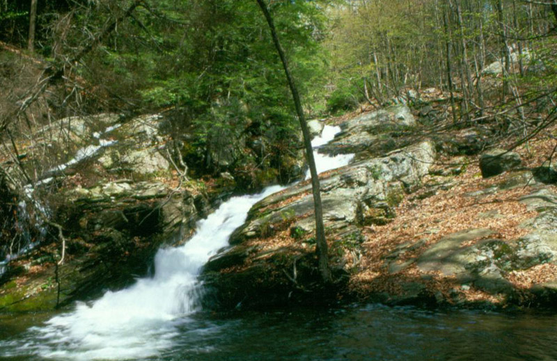
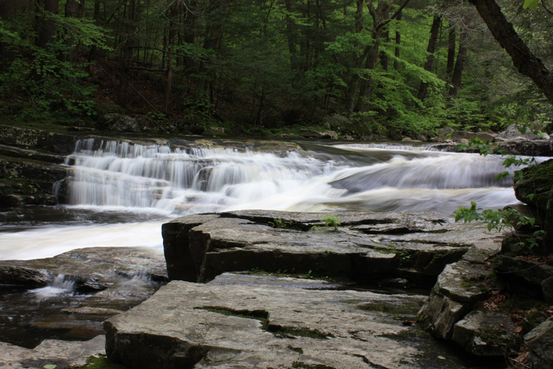
Falls on Turkey Hill Brook
(picture) |
FAIR |
Paxton |
I thought I had visited these falls on Turkey Hill Brook in 2003, but all I found was a DAM and some very small cascades below it; however, I have since seen photographs on the internet that suggest there may be more substantial cascades somewhere nearby; also, take note that the DAM and the historic building next to the cascades makes for a pretty and photogenic site even if there aren't any noteworthy falls here; also known as Turkey Hill Brook Falls |
| MA |
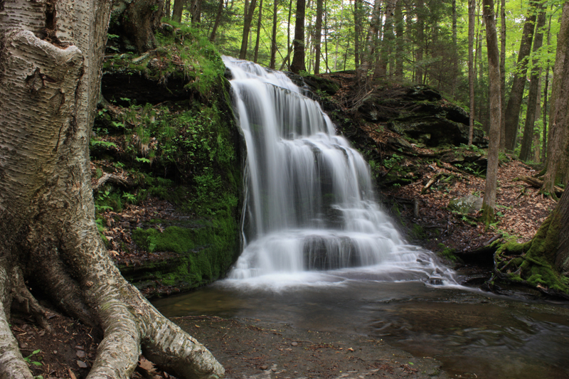
Four Mile Brook Falls
(picture) |
FAIR |
Northfield |
I visited these thin medium-angle falls on Four Mile Brook in 2002 but I am almost certain they were and still are located on PRIVATE PROPERTY |
| MA |
Gardner Falls |
POOR |
Shelburne Falls |
this is a DAM with a set of rapids below it on the Deerfield River; access may be possible from Gardner Falls Road; GPS = 42.591540, -72.730050 |
| MA |
Green River Falls |
unknown |
Williamstown |
access to these falls on the Green River may or may not be possible from the western edge of the Eastlawn Cemetery; no other information is known about these falls, but you can see whitewater on Google Maps (GPS = 42.707074, -73.199636); perhaps this is the same place as "Cascades at Green River Linear Park"? |
| MA |
Green Swamp Brook Falls |
unknown |
unknown |
I received this information about this rumored waterfall: "there may be a waterfall located on the south side of the massif, between the south ledges, just north of Bull Hill Road near Sunderland/Amherst Area" |
| MA |
Gunn Brook Falls
(picture) |
GOOD |
Sunderland |
I received emails in 2010 that the landowner got fed up with people leaving trash on his property so both the upper and lower falls are now PRIVATE PROPERTY; I revisited in 2016 and found that these falls are still on PRIVATE PROPERTY; skip this one for now and let this be a lesson to all of us that we need to do our part to help keep waterfalls trash-free |
| MA |
Hairpin Falls |
unknown |
Hidden Valley |
this is a rumored waterfall on Canyon Brook; it is most likely located on PRIVATE PROPERTY; the falls are likely located here: GPS = 42.711073, -73.059145 |
| MA |
Halfway Brook Falls |
FAIR |
unknown |
there appears to be a small cascade on Halfway Brook within Granville State Forest |
| MA |
Hawke's Brook Falls |
FAIR |
unknown |
pictures of these falls indicate they may be promising, but I was unable to find them in 2009; it is very likely the falls are on PRIVATE PROPERTY |
| MA |
Hawthorne Brook Cascades
(picture) |
POOR |
Pittsfield |
these falls are located in Pittsfield State Forest, close to Lulu Cascade and Parker Brook Cascades; I visited in 2009 and was not impressed; when I visited, there were a lot of downed trees and thick brush; requires a short bushwhack; the falls are honestly just plain ugly and are highly seasonal too (I suggest just skipping this one) |
| MA |
Hawthorne Falls |
FAIR |
Great Barrington |
these falls are highly seasonal, but perhaps they are still a worthwhile destination in high water; combine with a hike up Monument Mountain for good views of the southern Berkshires; hike is 0.5 mile one-way to the 30-foot falls; the well-marked trailhead for Monument Mountain is on MA 7 |
| MA |
Highland Falls |
FAIR |
Warwick |
this is one of several falls on the Metacomet-Monadnock (M&M) trail; I suspect the hike to the falls is somewhere in the 0.5-1.0 mile range each way |
| MA |
Honeymoon Falls & Gorge |
unknown |
Leverett |
rumored waterfall on Roaring Brook |
| MA |
Hubbard River Gorge & Falls
(picture) |
GOOD |
Granville |
this is a scenic mix of five notable sets of cascades and slides on the Hubbard River; the falls are all located within Granville State Forest and should be visible from the Hubbard River Trail; in years past, the state park has been very strict with NO SWIMMING rules because the Hubbard River is a major public water supply; the last time I visited in 2010, the trail was closed, so I am not sure if it has been re-opened or not; if the trail is open, it is likely 1.0-1.5 miles one-way to visit all falls |
| MA |
Keyes Brook Falls |
FAIR |
East Princeton |
this is a set of several small falls on Keyes Brook; public access unknown |
| MA |
Little River Falls |
unknown |
Huntington |
this appears to be a series of small falls on the Little River; it looks as though the falls may be visible from MA 112 (although a 10-15 foot downclimb off the road may be needed to fully see the falls); GPS = 42.326569, -72.872335 |
| MA |
Loudville Cascade |
FAIR |
Westhampton |
rumored waterfall; no other information known |
| MA |
Manchaug Falls |
POOR |
Sutton |
looks like a DAM; may also be called Sutton Falls; info here: https://www.suttonmass.org/about/pondlakeriver/manchaugfalls/ |
| MA |
Mason Brook Falls |
unknown |
Hubbardaston |
this is a rumored waterfall on Mason Brook; "easily accessible from Healdville Road, just enter from the New Westminster Rd. side of the brook" |
| MA |
Merrimac Falls |
POOR |
Lawrence |
this is a DAM on the Merrimack River that is near the MA 28 bridge; also known as Lawrence Falls |
| MA |
Mill Brook Falls-Northfield |
POOR |
Northfield |
these falls offer some easy roadside viewing, but are supposedly unattractive per several sources |
| MA |
Mitchell's Falls |
POOR |
Haverhill |
this is a set of rapids on the Merrimack River; GPS = 42.766179, -71.129870 |
| MA |
Noanet Brook Falls |
POOR |
Dover |
I am 99.99% sure this is a DAM within the Noanet Woodlands Reservation at the northern end of Upper Mill Pond |
| MA |
Observation Hill Falls |
POOR |
Chester |
looks slightly promising per pictures I have seen; really close to Goldmine Brook Falls, but I am not sure where to start hiking |
| MA |
October Mountain Falls |
unknown |
Lee?? |
rumored waterfall within October Mountain State Forest; one reader emailed me in 2011 and provided the following directions: "drive to end of the Navin Trail, and then a short walk to the brook that drains the grist pond on the right. From there a very short bushwack along the brook will bring you to the falls. No real trail there, but there are remnants of an old road visible in spots."; there is a chance this is the same waterfall as "Washington Mountain Falls" |
| MA |
Old Wendell Road Falls |
FAIR |
Northfield |
I could not find these falls in 2009 but I don't think I was looking in the correct spot; the falls look semi-impressive per photos I have seen; also called Hobo Falls and Feltman Falls; one reader of this website emailed me in 2016 and provided the following information: "the falls are best approached from the Gulf Rd side of Old Wendell Rd in Northfield. Where Old Wendell Rd tapers to a rocky unimproved washout, there is a kiosk with parking for 3-4 cars and then a 15 min. walk to a town forest sign on the left, and a trail that leads to the ledge base of the falls (5 minutes). It is sporadic but quite a steep drop down sheer ledge, maybe 70-90 feet in total? Footing is sketchy." |
| MA |
Pawtucket Falls |
POOR |
Lowell |
this is a DAM on the Merrimack River, although I have seen some pretty photographs of this site; I am not exactly sure where to park for the best view of these falls; also known as Pantukket Great Falls |
| MA |
Paxton Falls |
FAIR |
Paxton |
access to these falls is likely a short bushwhack off either Black Hill Road or Brigham Road; I highly suspect that the falls are on PRIVATE PROPERTY; please email me if you have more information on these falls (gparsons66@hotmail.com) |
| MA |
Pettibone Falls |
GOOD |
Cheshire |
these falls on Pettibone Brook are located on PRIVATE PROPERTY! these are very impressive and pretty falls, so hopefully a land trust like the BNRC can ultimately purchase and conserve this property (which would then allow the general public to visit the falls) |
| MA |
Pitcher Falls |
GOOD |
Cheshire |
there is so much conflicting information on these waterfalls on Pitcher Brook about whether they are open to the public or not; some say that the falls can only be visited by guests of the AMC Noble View Outdoor Center (the landowner is supposedly adamant about this); others say anybody can visit the falls; until this is sorted out, I would consider this PRIVATE PROPERTY and I would skip it to avoid confrontation with potential landowners |
| MA |
Powwow River Falls |
POOR |
Amesbury |
these falls on the Powwow River appear to be very small; access via Friend Street; there is a chance this is actually just a DAM (I just can't tell from pictures I have seen) |
| MA |
Rattlesnake Gutter |
unknown |
Leverett |
rumored waterfall; no other information known |
| MA |
Reeds Mill Falls |
POOR |
Conway |
there is a fair chance that these falls are surrounded by PRIVATE PROPERTY; the best chance of access is probably going to be Bardswell Ferry Rd. |
| MA |
Rock Dam |
POOR |
Greenfield & Turners Falls |
these falls on the Connecticut River are reportedly very small, but they could still be worth a look and a photograph; a 0.5 mile one-way hike is required; the "Waterfalls of Massachusetts" guidebook has directions; GPS = 42.595468, -72.578939 |
| MA |
Sages Ravine (Lower Falls) |
GREAT |
Mount Washington |
these falls on Sages Ravine Brook are more impressive than the upper falls, but reaching these falls requires a difficult and steep bushwhack of up to 1.0 mile each way (the falls start after hiking on a trail for the first 0.3 mile); the bushwhacking starts from MA 41 not far from the Connecticut border across the street from "Falls on Sages Ravine Brook"; one of the falls along this bushwhack is also known as Twin Falls |
| MA |
Sawmill River Falls |
FAIR |
Leverett |
these falls on the Sawmill River are likely located on PRIVATE PROPERTY; however, you may be able to see a portion or all of the falls from Rattlesnake Gutter Road; GPS = 42.491954, -72.476542; also called Saw Mill River Falls (although that spelling is probably wrong because the river is called the Sawmill River); there appears to be some conservation area nearby, so perhaps one side of the falls is open to the public? or perhaps you can see the falls from the conservation area?; this may actually be the same falls as "Rattlesnake Gutter" |
| MA |
Slip Dog Falls |
FAIR |
Sunderland |
this is a highly seasonal 10-foot tall falls on Gunn Brook; the trailhead is off Reservation Road and a 1.5 mile hike one-way is required; the "Waterfalls of Massachusetts" guidebook has directions |
| MA |
Sluice Brook Falls-Lower Falls |
FAIR |
Shelburne |
access for these 30-foot falls on Sluice Brook is supposedly only possible by canoeing or kayaking on the Deerfield River; I have heard it's impossible to scramble down to these falls from the upper falls, which can be reached via trail |
| MA |
Sluice Brook Falls-Upper Falls |
FAIR |
Shelburne |
historically, the way to reach these falls was to park at 'Wilcox Hollow" and then take a 1.0-1.5 mile hike (one-way) southeast along the bank of the Deerfield River to reach the 10-foot upper falls; however, this section of trail has run into the some private property issues and it is no longer possible to reach these upper falls from Wilcox Hollow; instead, you have to hike 3.0 miles (one-way) northwest along the Mahican-Mohawk Trail |
| MA |
South Hadley Falls |
POOR |
South Hadley |
this is a DAM on the Connecticut River; the DAM may be viewable from MA 116 and/or from within the Hadley Falls Canal Park; also known as Holyoke Falls |
| MA |
Spot Pond Brook Falls |
POOR |
Stoneham |
this is a 10-foot stone DAM on Spot Pond Brook that is likely to be highly seasonal; access may be possible via Ravine Road and/or the Virginia Wood Trail; here is the rough area to look = 42.455607, -71.086106; the "Waterfalls of Massachusetts" guidebook has directions |
| MA |
Sutton Falls |
POOR |
Sutton |
this could either be a small waterfall or it could be a DAM on the Mumford River; the falls are supposedly located between Sutton Pond and Manchaug Pond |
| MA |
Turners Falls |
POOR |
Turners Falls |
this is a huge DAM on the Connecticut River; the DAM should be visible from Main Road / Avenue Ave just off MA 2 |
| MA |
Unnamed |
unknown |
Rutland |
per an email I received in November 2018: "there are two cascades in the town of Rutland, Massachusetts. They're both along Mill Brook off of Charnock Hill Road. Both of them are 20-30 feet and can be quit scenic at high water (however there is a litter problem). I believe they are both remnants of old mills. There is a decently marked trail and the first cascade is maybe 200 feet down and the second is a few hundred feet further (but the trail ends at the first)." |
| MA |
Upper Falls |
unknown |
Montague |
this is a rumored waterfall on the Sawmill River; the falls may be visible from Main Street, although it is likely a short walk or bushwhack is requird; there is a good chance that the falls are surrounded by PRIVATE PROPERTY |
| MA |
Wallamanumps Falls |
POOR |
Ludlow |
this is a large DAM on the Chicopee River with some small cascades/rapids below it; the DAM should be visible from Ludlow Avenue; although this a dam, I have seen some pretty photographs and videos of the falls |
| MA |
Washington Mountain Falls |
unknown |
Washington |
this is a rumored waterfall in or near October Mountain State Forest; there is a good chance this is the same waterfall as "October Mountain Falls" |
| MA |
Waverly Falls |
unknown |
Waverly |
this is a rumored waterfall on Beaver Brook; it is highly probable that this is the same waterfall as Beaver Brook Falls |
| MA |
West Branch Falls |
unknown |
West Chesterfield |
this is a waterfall on the West Branch of the Westfield River; the falls are only a short distance north of Main Road (MA 143), but it is extremely likely that the falls are located on PRIVATE PROPERTY; GPS = 42.414289, -72.900598 |
| MA |
West Worthington Falls |
FAIR |
West Worthington |
these falls are either on the Middle Branch of the Westfield River or Trout Brook (I'm not sure which); the falls are believed to be located on PRIVATE PROPERTY, although they may be partially visible from River Road; GPS = 42.418532, -72.983704 |
| MA |
West Brook Falls |
GOOD |
Whately |
there are supposedly two waterfalls here - an upper falls and a lower falls; the lower falls are almost certainly located on PRIVATE PROPERTY; the upper falls may or may not be on PRIVATE PROPERTY; access is supposedly via Westbrook Road |
| MA |
Westfield River Falls |
POOR |
Chesterfield |
this is a set of rapids on the Westfield River; GPS = 42.383509, -72.870762 |
| MA |
Wheeler Brook Falls |
unknown |
Savoy |
this is a rumored waterfall on Wheeler Brook; access may require a short bushwhack north from MA 2 |
| MA |
Wheeler Brook Falls |
unknown |
Greenfield |
this is another rumored waterfall on Wheeler Brook; access unknown |
| MA |
Whipple's Falls |
unknown |
Lowell |
this appears to be a set of small cascades or rapids on the Concord River; GPS = 42.637900, -71.303089; access may or may not be possible from Lawrence Street, but I can see there are lots of houses in the area |
| MA |
Whitman's Falls |
FAIR |
Weymouth |
these falls on Herring Run Brook are supposedly close to a parking lot near the end of Whitman Pond; access should be possible via Iron Hill Road and the Iron Hill Park; the falls are expected to be 10 or 12 feet tall; I have heard reports that there is a fence around the falls so that fish can climb a fish ladder upstream; these falls are also known as Iron Hill Falls |
| MA |
Wicassic Falls |
POOR |
Tyngsborough |
this was once a waterfall on the Merrimack River, but it has since been drowned by a DAM that was constructed downstream |
