Top Family-Friendly Hikes in New England
Looking for a highly rewarding family-friendly hike in New England? After reviewing dozens of guidebooks, hiking hundreds of trails, and inquiring with hordes of other hikers, I am proud to present a list of what I believe covers the very best 'bang for the buck' easy day hikes for families. See below for the complete list of the top family-friendly hikes in New England, but please read the following safety reminders before doing so:
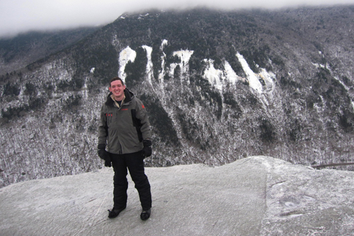
Some of the hikes I've listed below can be extremely dangerous in poor weather, and also when wet or icy conditions exist. Before hiking, you absolutely need to make sure to check the local weather forecast and consider the conditions before you go. To be fully prepared for the mountains, I would bring enough warm clothes to be prepared for temperatures that are at least 10-15 degrees below the weather forecast of the closest town or city to where that hike is located.
Make sure to pack all of the following items for your hike:
- food/snacks
- water (also consider a sports drink, such as Powerade or Gatorade)
- warm clothing (a waterproof jacket is also recommended)
- sunscreen
- bug spray (if hiking from May through mid-July)
- hiking shoes or boots
- guidebook & map
- camera
- headlamp/flashlight
- first-aid supplies
Each of the day hikes listed below is rated from easy to moderate in terms of difficulty. However, gaging difficulty for hikes is relative to the individual. If you have never done a day hike before, these hikes may seem much more difficult than what I have listed them as.
I hope you enjoy this list. Take note that it is not sorted by rank.
Follow New England Waterfalls on Facebook! 
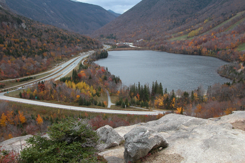
BALD MOUNTAIN / ARTIST BLUFF LOOP
| STATE |
TOTAL MILEAGE |
DIFFICULTY |
NOTES & HIGHLIGHTS |
| NH |
1.5 miles |
Easy Side of Moderate |
beautiful open views of Echo Lake (not the one in North Conway) and much of Franconia Notch State Park; requires a short but steep hike; trailhead is near Cannon Mountain off NH 18 |
TABLE ROCK
| STATE |
TOTAL MILEAGE |
DIFFICULTY |
NOTES & HIGHLIGHTS |
| ME |
2.8 miles
estimated) |
Easy Side of Moderate |
beautiful open views of much of Grafton Notch State Park; when hiking in, make sure you take the second spur trail on the right to Table Rock (do NOT take the first spur trail as it is very steep and dangerous when wet or icy!); if you want to keep hiking, you can extend hike to visit the Baldplates |
LONESOME LAKE
| STATE |
TOTAL MILEAGE |
DIFFICULTY |
NOTES & HIGHLIGHTS |
| NH |
3.0 miles |
Easy Side of Moderate |
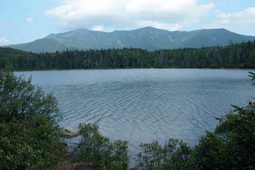
beautiful, remote pond in Franconia Notch; a steady but relatively easy climb brings you to the shore of this lake; once you reach the lake, you can hike around completely around it and also visit the open year-round AMC Lonesome Lake Hut (lodging available with reservations); beautiful views of the Franconia Range from the western lake-shore, so try to save this hike for a clear day; access is via the Lonesome Lake Trail, which begins at the Lafayette Place Campground (access via the I-93 south side) |
GREAT ISLAND TRAIL
| STATE |
TOTAL MILEAGE |
DIFFICULTY |
NOTES & HIGHLIGHTS |
| MA |
6-7 miles |
Moderate |
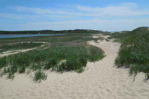
widely considered to be Cape Cod's best hike; deserted beaches and sand dunes; hiking is mostly flat, but nearly all of this hike involves walking on sand, which some may find tiring; since this is managed as a semi-wilderness area, you may find trash and dead animals (dolphins, seals, etc.) along the beach |
MOUNT MAJOR
| STATE |
TOTAL MILEAGE |
DIFFICULTY |
NOTES & HIGHLIGHTS |
| NH |
4.0 miles |
Moderate |
one of the two best lakes-region hikes (the other is West Rattlesnake), Mt. Major offers a fun climb to dazzling views of many bays and coves; several loop options available (search for map online); do NOT attempt in poor weather as some as some scrambling is involved on almost all trails! |
MOUNT MONADNOCK
| STATE |
TOTAL MILEAGE |
DIFFICULTY |
NOTES & HIGHLIGHTS |
| NH |
Varies, but most common option is 4.4 miles |
Moderate |
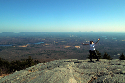
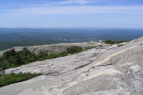
one of the most famous mountains in the world, Mt. Monadnock is rugged & scenic, all despite its small size (it's not even close to being a 4000-footer); the most common route is a loop up the White Dot Trail and down the White Cross Trail; however, there are many other less-crowded routes on this mountain (ranging in difficulty from moderate to difficult); parking fee required; generally snow & ice free by late April; avoid on holiday weekends as crowds can be unbearable; do NOT attempt in poor weather! |
MOUNT CARDIGAN
| STATE |
TOTAL MILEAGE |
DIFFICULTY |
NOTES & HIGHLIGHTS |
| NH |
5.5 miles |
Moderate |
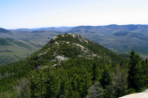
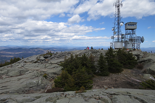
the tallest and best mountain in central NH; huge open summit with room for all; several different route options available, but the easiest is probably up and down the West Ridge Trail; the following loop is more challenging but is a personal favorite: Manning Trail > Holt Trail > Holt-Clark Cutoff > Clark Trail > Mowglis Trail > Manning Trail; do NOT take the entire Holt Trail to the summit as it is extremely steep and potentially dangerous (get a map to make sure you take the correct trails); the easier trails are popular with cross-country skiers and snowshoers in winter; do NOT attempt in poor weather; beware when the summit is slippery from rain or ice! |
MOUNT WILLARD
| STATE |
TOTAL MILEAGE |
DIFFICULTY |
NOTES & HIGHLIGHTS |
| NH |
3.2 miles |
Easy Side of Moderate |
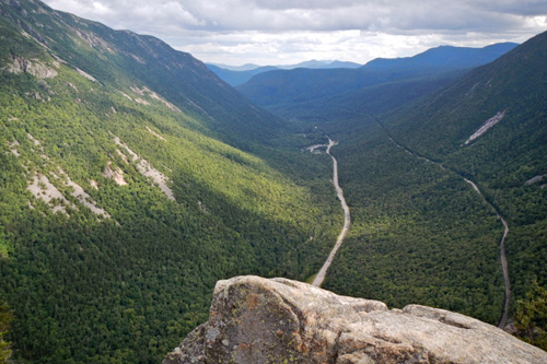
offers wide, scenic views of Crawford Notch; an outstanding adventure for first-time hikers; a favorite (relatively easy) winter snowshoeing trip; trailhead begins near AMC Crawford Notch Depot on US 302 |
STOWE PINNACLE
| STATE |
TOTAL MILEAGE |
DIFFICULTY |
NOTES & HIGHLIGHTS |
| VT |
2.8 miles |
Moderate |
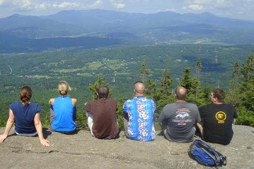
a bald open summit on the edge of the town of Stowe; features great views of the town and a huge chunk of the Green Mountains; a family-friend, high "bang-for-the-buck" type of hike; don't miss nearby Moss Glen Falls-Stowe if you like waterfalls |
WELCH & DICKEY LOOP
| STATE |
TOTAL MILEAGE |
DIFFICULTY |
NOTES & HIGHLIGHTS |
| NH |
4.5 miles |
Moderate |
only two hours north of Boston, this loop has fantastic views and is one of the top 10 "bang for the buck" hikes in New England; do not hike when wet or icy since the open slabs will be very slippery; trailhead access is near Waterville Valley; do NOT attempt in poor weather! |
WEST RATTLESNAKE
| STATE |
TOTAL MILEAGE |
DIFFICULTY |
NOTES & HIGHLIGHTS |
| NH |
1.8 miles |
Easy Side of Moderate |
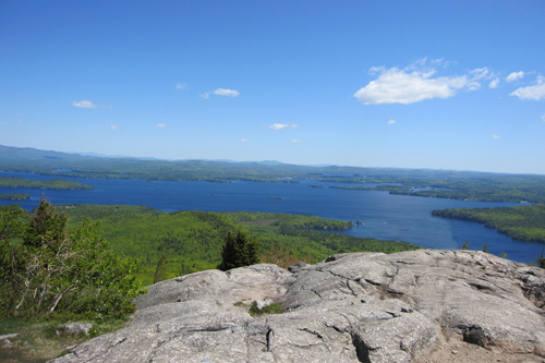
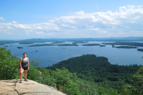
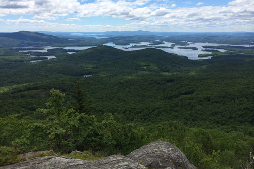
one of the best views of lakes anywhere in New England; beautiful unobstructed views of Squam Lake; access is via the moderately steep Old Bridle Path (out-and-back); photographs never do this place justice, so this is one you'll just have to come see for yourself |
ARETHUSA FALLS
| STATE |
TOTAL MILEAGE |
DIFFICULTY |
NOTES & HIGHLIGHTS |
| NH |
3.0 miles |
Moderate |
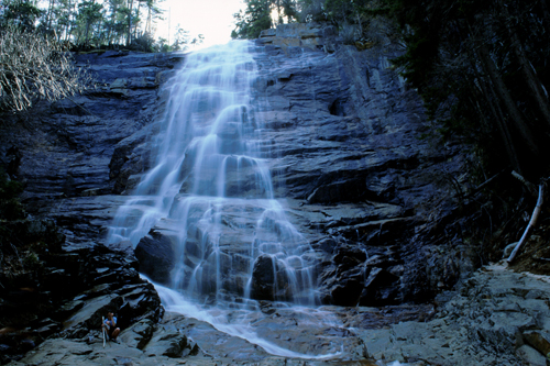
arguably the finest waterfall in New England; 160-foot tall gorgeous horsetail-style falls; can be combined with nearby Ripley Falls and a hike up Frankenstein Cliffs; popular with ice climbers in winter; a great (and relatively safe) first-time snowshoeing adventure |
MOUNT HUNGER
| STATE |
TOTAL MILEAGE |
DIFFICULTY |
NOTES & HIGHLIGHTS |
| VT |
4.0 miles |
Moderate |
beautiful views of the Stowe area from the summit of this 3,539ft mountain; long views of the Green Mountains; can also combine with a spur trail to equally scenic Stowe Pinnacle |
Photo Credit: Adam Kavanaugh
MIDDLE SUGARLOAF
| STATE |
TOTAL MILEAGE |
DIFFICULTY |
NOTES & HIGHLIGHTS |
| NH |
2.6 miles to Middle Sugarloaf only;
3.2 miles to both Middle & North Sugarloaf |
Moderate |
one of the great 'bang for the buck' hikes in the White Mountains; a hike of only 2.6 miles brings you to the summit of Middle Sugarloaf, which offers some of the finest views in the White Mountains from huge open ledges; extend your hike to 3.2 miles in total and you can also visit North Sugarloaf, which offers excellent views from two different viewpoints; access via well-marked trailhead off Zealand Road (open seasonally; located off US 302); the trail to both summits is a moderate climb with a fair amount of elevation gain, and there is also a tall but secure ladder in place on the way to Middle Sugarloaf that those with a strong fear of heights may not appreciate; if you finish this hike and want more, combine with nearby Mt. Willard, which is another classic "bang for the buck" hike |
PURGATORY CHASM
| STATE |
TOTAL MILEAGE |
DIFFICULTY |
NOTES & HIGHLIGHTS |
| MA |
1.0 miles |
Easy Side of Moderate |
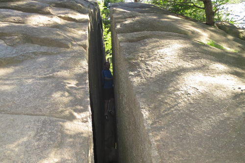
very fun boulder scrambling and a few small boulder caves can be found within this very interesting chasm (a chasm is very similar to a gorge); bring a picnic and plan on spending hours here; do not visit when it is wet or icy (ice can linger into April or even early May); can be very crowded on weekends; don't miss trying to squeeze through 'Fat Man's Misery' (see picture below) |
THE ROOST
| STATE |
TOTAL MILEAGE |
DIFFICULTY |
NOTES & HIGHLIGHTS |
| ME |
1.2 miles |
Moderate |
open ledges provide great views in the Evans Notch region of the White Mountains; lots of wild and edible blueberries in season (typically late July / early August); in 10-20 years, much of the view here is likely to become obscured as trees continue to grow |
THE BUBBLES
| STATE |
TOTAL MILEAGE |
DIFFICULTY |
NOTES & HIGHLIGHTS |
| ME |
1.6 miles |
Moderate |
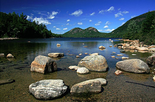
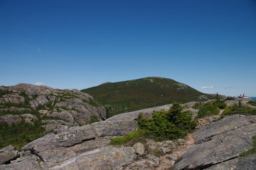
visits South & North Bubble, each of which has excellent views; located within Acadia National Park, which has an extensive trail network; you can easily extend this hike to include walking along the shores of Eagle Lake |
Photo Credit: Kathy Varn Hawkins
BEAR MOUNTAIN
| STATE |
TOTAL MILEAGE |
DIFFICULTY |
NOTES & HIGHLIGHTS |
| CT |
6.0 miles |
Moderate |
excellent views from Connecticut's tallest peak; located in the far northwest corner of Connecticut; take the Undermountain Trail out-and-back |
NORTH PACK MONADNOCK
| STATE |
TOTAL MILEAGE |
DIFFICULTY |
NOTES & HIGHLIGHTS |
| NH |
3.2 miles |
Moderate |
great views from open ledges of the Monadnock region; take the Wapack Trail from trailhead on Old Mountain Rd; nearby South Pack Monadnock also has summit trails & great views, but you can drive to the top of that summit |
KEARSARGE SOUTH
| STATE |
TOTAL MILEAGE |
DIFFICULTY |
NOTES & HIGHLIGHTS |
| NH |
2.7 miles |
Moderate |
fantastic views from bald summit; several trails lead to the summit, but the Wilmot & Barlow Trail loop is generally regarded as the most rewarding; the 1.2 mile round-trip Warner Trail is an easier option |
MOUNT MORGAN & MOUNT PERCIVAL LOOP
| STATE |
TOTAL MILEAGE |
DIFFICULTY |
NOTES & HIGHLIGHTS |
| NH |
5.4 miles |
Moderate |
features excellent views and also several fun trail ladders & boulder caves; one of the finest half-day hikes in the southern White Mountains; boulder caves not recommended in wet or icy conditions |
Photo Credit: Katie Kozin
ALANDER MOUNTAIN
| STATE |
TOTAL MILEAGE |
DIFFICULTY |
NOTES & HIGHLIGHTS |
| MA |
5.6 miles |
Moderate |
offers some of the best views in the Berkshires; located in the far southwest corner of the state; features some open ridge walking; since you probably had to drive very far to get here, you might as well visit nearby Bash Bish Falls as well |
SLEEPING GIANT
| STATE |
TOTAL MILEAGE |
DIFFICULTY |
NOTES & HIGHLIGHTS |
| CT |
Varies |
Moderate |
good views from a beautiful stone tower; several loop options to choose from (several great options are available in the 5-6 mile range) |
TUMBLEDOWN MOUNTAIN
| STATE |
TOTAL MILEAGE |
DIFFICULTY |
NOTES & HIGHLIGHTS |
| ME |
4.0 miles
(estimated) |
Moderate |
scenic views, open ridges, and an attractive backcountry pond; one of the most challenging hikes listed on this page; some scrambling is involved I believe |
Photo Credit: Michael Saletnik
RUNNER-UPS
Each of the following hikes was a close contender when I was deciding which hikes were the true classics. I highly recommend each of these hikes as well. I would rate each of them at least a "9" scenic beauty.
| THE HIKE |
STATE |
TOTAL MILEAGE |
DIFFICULTY |
NOTES & HIGHLIGHTS |
| Bash Bish Falls |
MA |
0.8-1.0 miles |
Easy |
Massachusetts' most dramatic waterfall; 80-foot total drop; absolutely gorgeous in winter; one trailhead is in MA (0.8 miles round-trip) and one trailhead is in NY (1.0 miles round-trip) |
| Black Cap |
NH |
2.4 miles |
Easy Side of Moderate |
great views from ledges; visit soon as trees are starting to slowly diminish the views |
| Black Mountain (Benton) |
NH |
4.6 miles |
Moderate |
follow the Black Mountain Trail along an old fire road; this mountain can also be hiked by the steeper Chippewa Trail; access road is closed in winter |
| Boulder Loop Trail |
NH |
3.1 miles |
Moderate |
a series of excellent views along a classic loop; one of the more challenging hikes listed on this page |
| Bradbury Mountain |
ME |
Varies, but shortest is 0.6 miles |
Varies based on route
(Easy Side of Moderate to Moderate) |
scenic views from the summit; several summit trails to choose from; located within Bradbury Mountain State Park, which has a diverse network of trails for hikers and mountain bikers; popular with snowshoers |
| Bridal Veil Falls |
NH |
5.0 miles |
Moderate |
one of the loveliest (and easiest) half-day hikes in New Hampshire; beautiful waterfall is found at the end of the trail; don't miss the Bette Davis plaque (if you can find it) |
| Cadillac Mountain |
ME |
Varies, but shortest option is 2.8 miles |
Moderate |
the tallest point in Acadia National Park has gorgeous views (just make sure to go a little bit off trail to avoid the crowds that drive up the auto road); several different route options exist to hike this peak (including the South Ridge Trail that starts at the Blackwoods Campground) |
| Crystal Cascade |
NH |
0.8 mile |
Easy Side of Moderate |
a stunning waterfall at the base of White Mountains; follow the Tuckerman Ravine Trail from the AMC Pinkham Notch Center and climb a set of stairs to view the falls |
| Flume, The |
NH |
2.0 mile loop |
Easy Side of Moderate |
extremely popular hike in Franconia Notch State Park, but it's well worth dealing with all the crowds and the expensive admission fee in my opinion; beautiful gorge and waterfalls along boardwalk trail; |
| Franconia Falls |
NH |
6.4 miles |
Easy Side of Moderate |
easy walk to some waterfalls and very fun swimming holes (only swim when the river level is low) |
| Hulburt's Hill (Bartholomew's Cobble) |
MA |
1.8 miles |
Easy Side of Moderate |
relatively easy but nearly continuous uphill walk to one of the finest views in the Southern Berkshires; far-reaching and unobstructed countryside views; fee if you are not a member of the Trustees of Reservations; take the Tractor Path all the way to the top of the hill. |
| Mount Cube |
NH |
6.6 miles |
Moderate |
open ledges with excellent views; one of the best views in the southern White Mountains |
| Mount Holyoke |
MA |
Varies |
Moderate |
located within Skinner State Park; several routes available, including the Black Rock Trail and the very popular Metacomet-Monadnock Trail (M-&-M trail) |
| Mount Pisgah |
VT |
3.8 miles |
Moderate |
lofty views of Willoughby Lake, which is one of the most scenic bodies of water in New England |
| Mount Roberts |
NH |
5.0 miles |
Moderate |
coming soon.... |
| Mount Tom |
MA |
5.2 miles
estimated) |
Moderate |
great views of the Connecticut Valley; summit accessed via Metacomet-Monadnock Trail (M-&-M trail); located within the Mount Tom State Reservation, which has a large network of trails; trail map can be found here: https://www.mass.gov/eea/docs/dcr/parks/trails/mtom.pdf |
| Mount Wachusett |
MA |
Varies |
Moderate |
good views from the summit; within the Wachusett Mountain State Reservation, which offers a good network of trails; trail map can be found here: https://www.mass.gov/eea/docs/dcr/parks/trails/wachusett.pdf |
| Mount Watatic |
MA |
2.2 miles |
Moderate |
rocky ledges at the summit offer great views; hike up the Wapack Trail; can be turned into a 4-mile loop; one of Massachusetts' most popular hikes |
| Moxie Falls |
ME |
1.2 miles |
Easy |
arguably Maine's finest waterfall; 90-foot tall drop with additional cascades above and below; popular with tourists who are staying in the area to go whitewater rafting on either the Kennebec River or Dead River |
| Pleasant Mountain |
ME |
3.6 miles |
Moderate |
beautiful views of several lakes; blueberries in season (typically late July/early August) |
| Pine Mountain |
NH |
3.5 miles |
Moderate |
awesome views for the effort involved; popular with campers staying at nearby Dolly Copp Campground; easiest access is via trailhead on Dolly Copp / Pinkham B Road, but you can also hike from a trailhead near the center of Gorham |
| Race Brook Falls |
MA |
2.0 miles |
Moderate |
visits several sets of beautiful falls; can also extend hike and hike Mt. Everett or Mt. Race |
| Square Ledge |
NH |
1.0 mile |
Moderate |
fine views from rocky ledge; can also combine with a visit to nearby Lost Pond (hike Square Ledge last since it has better views); take Lost Pond Trail from the AMC Pinkham Notch Center and then following signs to Square Ledge |
| Talcott Mountain |
CT |
2.5 miles |
Easy Side of Moderate |
great views and a historic tower on the summit; shortest route is via the Tower Path; can also be reached via the Metacomet-Monadnock Trail (4 miles round-trip if coming from the north or 6 miles road-trip if coming from the south) |
| Wheeler Mountain |
VT |
2.3 miles |
Easy Side of Moderate |
great views en route and at the summit |
| Zealand Falls / Zealand Falls Hut |
NH |
5.0 miles |
Easy Side of Moderate |
very pleasant walk past beaver ponds to nice waterfall and an AMC Hut (lodging available, but reserve well in advance); waterfall is best viewed after heavy rains or early in the spring (May-ish time-frame) |
|

