New England Waterfalls hompeage Connecticut Waterfalls Maine Waterfalls Massachusetts Waterfalls New Hampshire Waterfalls Rhode Island Waterfalls Vermont Waterfalls Top 100 US Waterfalls New England Waterfalls guidebook on Amazon New England Waterfalls guidebook on Amazon New England Waterfalls header bar

Top 25 Hikes in New England


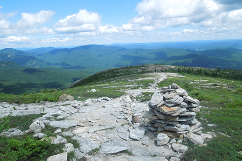
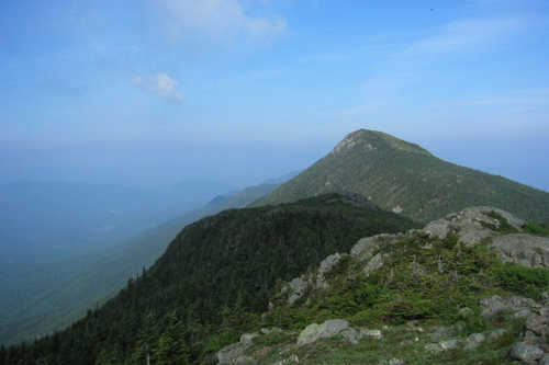
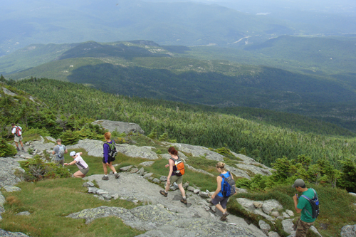
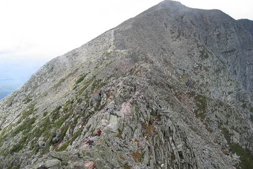
New England has thousands of miles of trails, and you find an abundance of trails to waterfalls, swimming holes, alpine summits, backcountry lodges, lean-to shelters, fire towers, cabins, lakes and ponds all throughout this region.

But which hikes in New England are widely considered to be the very best? Everyone has their own favorites, but I believe these are the ultimate 25 scenic hikes in New England. You can't go wrong with any of these hikes - I highly recommended each and every one of them. In fact, we'd rate each of them a '10' in scenic beauty, and I am very confident that you will too.

The hikes listed below are in alphabetical order (they are not sorted by scenic rank).

If you would like detailed driving directions and trail guides for these hikes, I recommend purchasing these long-trusted hiking guidebooks:

AMC: White Mountain Guide (31st edition)
AMC: Best Day Hikes in the White Mountains (4th edition)
Moon: New England Hiking (1st edition)

Lastly, if you want some inspiration and ideas on some of the best hikes across the rest of the United States, visit my other website, Bigroads.com: Top 100 Day Hikes in the United States.

Follow New England Waterfalls on Facebook! facebook icon


BALDFACE LOOP
STATE TOTAL MILEAGE DIFFICULTY NOTES and HIGHLIGHTS
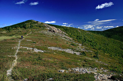
NH 9.7 mile loop Very Difficult this is a challenging but classic loop over the twin summits of South Baldface and North Baldface most hike this loop clockwise in order to ascend the steepest sections of the loop (which is the ledges of South Baldface) each of the Baldfaces offers outstanding views most will agree that this is the best hike in the Evans Notch (Route 113) region of the White Mountains do not attempt this hike when wet as the ledges on South Baldface can be slippery and perhaps even potentially dangerous plentiful blueberries in season (which is typically from late July through early August) don't miss swimming and cliff-jumping at the cold but gorgeous Emerald Pool on your way out (best on an 80+ degree day) can be done as a backpack by staying at the Baldface Shelter en route access via trailhead parking area on the east side of NH 113 (north of Chatham and Fryeburg)

views from ledges on South Baldface DIRECTIONS / TRAIL GUIDE
AMC's White Mountain Guide (31st edition)

BIGELOW MOUNTAIN / AVERY PEAK LOOP
STATE TOTAL MILEAGE DIFFICULTY NOTES and HIGHLIGHTS
ME 12.4 mile loop Very Difficult features some of the most extraordinary hiking terrain in all of Maine don't miss the short detour to the top of Avery Peak several backcountry camping options are available (Moose Falls, Avery Col, Horns Pond and Cranberry Stream campsites) for those that don't want to hike this in a single day ascend via the Fire Warden's Trail if you want to do the traditional 12.4 mile loop do not attempt in foul weather as much of this hike is above treeline typically snow-and-ice-free from late May/early June through early October (like most 4000-footers in New England)

The Bigelows DIRECTIONS / TRAIL GUIDE
AMC's Maine Mountain Guide (11th edition)
Photo Credit: Michael Saletnik

CAMEL'S HUMP
STATE TOTAL MILEAGE DIFFICULTY NOTES and HIGHLIGHTS
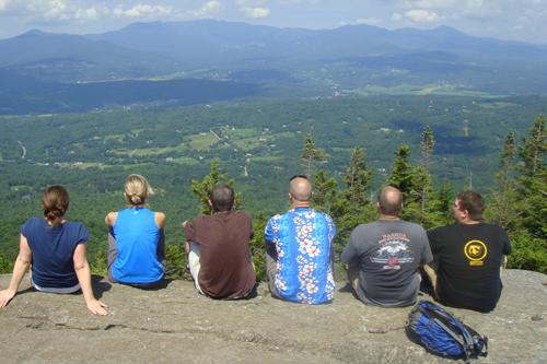
VT 6.4 miles Difficult many would argue that this is the finest big peak in Vermont there are several approach trails the finest route is probably the Forest City > Long Trail > Burrows Trail loop views are incredible from its bald and rocky summit two nearby cabins/shelters along the Long Trail provide some basic but memorable backcountry lodging options the wildest and least commercially developed of Vermont's five 4000-footers typically snow-and-ice-free from late May/early June through early October (like most 4000-footers in New England)

Camel's Hump DIRECTIONS / TRAIL GUIDE
Hiking the Green Mountains
100 Classic Hikes in New England
50 Best Hikes in New England

KATAHDIN
STATE TOTAL MILEAGE DIFFICULTY NOTES and HIGHLIGHTS
ME Varies, but the most common loop is 9.6 miles Extremely Difficult one of the most alpine mountains on the East Coast this is undoubtedly the most scenic and challenging hiking that you will find east of the Rocky Mountains several routes/trails reach the summit, and each is very difficult but spectacular don't miss scrambling along the gnarly 'Knife's Edge' if you can score a parking permit at the Roaring Brook Trailhead (reserve online weeks in advance) do not attempt this mountain in foul weather advance parking permits required for all trailheads on this mountain (see the website of the Baxter State Park Authority) a common loop on Katahdin is Chimney Pond Trail > Helon Taylor > Knife's Edge > Saddle Trail > Chimney Pond Trail many combine hiking Katahdin with a summit of Hamlin Peak (another Maine 4000-footer), but this makes for one heck of a long and challenging day hike you can reserve lean-tos at Chimney Pond to make the day hike of this mountain a tad bit easier (reserve well in advance and be prepared for potential disappointment as this place is wildly popular) while you are in the area, you might as well take a guided whitewater rafting trip down the wild & scenic Penobscot River

Knife Edge, Katahdin DIRECTIONS / TRAIL GUIDE
AMC's Maine Mountain Guide (11th edition)

MIDDLE & NORTH SUGARLOAF
STATE TOTAL MILEAGE DIFFICULTY NOTES and HIGHLIGHTS
NH 2.6 miles to Middle Sugarloaf only;
3.2 miles to both Middle and North Sugarloaf
Moderately Difficult one of the great "bang for the buck" hikes in the White Mountains a hike of only 2.6 miles round-trip brings you to the summit of Middle Sugarloaf, which offers some of the finest views in the White Mountains from huge open ledges extend your hike to 3.2 miles in total and you can also visit North Sugarloaf, which offers its own excellent views from two different viewpoints access is via well-marked trailhead / parking area off Zealand Road (open seasonally; Zealand Road is located off US 302) the trail to both summits is a moderate climb with a fair amount of elevation gain, and there is also a tall but securely-fashioned ladder in place on the way to Middle Sugarloaf that those with a strong fear of heights may not appreciate to much if you finish this hike and want more, combine with a quick hike up nearby Mt. Willard, which is another one of the classic 'high bang for the buck' hikes in the White Mountains.

views of Twin Mountain from Middle Sugarloaf DIRECTIONS / TRAIL GUIDE
AMC's White Mountain Guide (31st edition)

MOUNT ADAMS
STATE TOTAL MILEAGE DIFFICULTY NOTES and HIGHLIGHTS
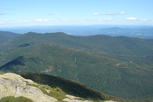
NH Varies, but the shortest option is 8.6 miles Very Difficult a favorite New Hampshire peak of so many hikers, Mt. Adams is ruggedly spectacular offers alpine views for miles in all directions there are over a dozen loop options to choose from when climbing this peak, so study trail maps ahead of time do not attempt in foul weather as you could easily get lost or injured look at a trail map very closely to choose trails that see some of the waterfalls of Appalachia on the way up (or down) can be combine with Mt. Madison or Mt. Jefferson, but doing two of three of these mountains in one day is very, very, difficult you will absolutely want to bring a map for this peak, especially if you want to see some waterfalls en route typically snow-free from early June to early October (like most of the big mountains in NH) most trails to this mountain begin at the well-marked 'Appalachia' hikers parking lot on US 2 in Randolph.

views of Mt. Madison from Mt. Adams DIRECTIONS / TRAIL GUIDE
AMC's White Mountain Guide (31st edition)

THE BONDS TRAVERSE
STATE TOTAL MILEAGE DIFFICULTY NOTES and HIGHLIGHTS
NH 19.5 miles Extremely Difficult a trip over 'The Bonds' includes the 4000-plus foot peaks of West Bond, Mount Bond and Bondcliff these peaks are often hiked together as part of a long and tough one-day or backpacking traverse from a trailhead on Zealand Road (off US 302) to the Lincoln Woods trailhead (off NH 112), or vice versa (with a quick side trip to Zealand Mountain en route) many will hike The Bonds as part of a 1 to 2+ night overnight trip (lodging available at Zealand Falls Hut and Galehead Hut, and shelter and backcountry tenting is available at Guyot Shelter) views from all three of the Bonds are wildly spectacular do not attempt hiking the ridge between Mount Bond and Bondcliff in foul weather the photo-opportunity from Bondcliff is legendary (see below for picture) sunsets from West Bond can be spectacular (and are within a relatively easy jaunt from the campsites and shelter at Guyot Shelter) avoid staying at Guyot on weekends because it's a complete zoo

classic view of Bondcliff DIRECTIONS / TRAIL GUIDE
AMC's White Mountain Guide (31st edition)

MOUNT CARDIGAN
STATE TOTAL MILEAGE DIFFICULTY NOTES and HIGHLIGHTS
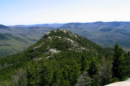
NH minimum of 3.1 miles, but there are longer routes available Moderately Difficult the biggest and best mountain in central NH huge open summit with room for all several different route options available, but one of the best is the following: Manning Trail > Holt Trail > Holt-Clark Cutoff > Clark Trail > Mowglis Trail > Manning Trail (this 5.5 mile loop begins from the AMC Cardigan Lodge, where overnight bunks are offered) take the entire Holt Trail if you are looking for a seriously scrambly (class III) adventure (must be avoided when wet or icy) the easier trails are popular with cross-country skiers and snowshoers in winter there is also a backcountry hut that groups of up to 12 can rent (AMC High Cabin)

ledges on Mt. Cardigan DIRECTIONS / TRAIL GUIDE
AMC's Southern NH Trail Guide (5th edition)

MOUNT CARRIGAIN
STATE TOTAL MILEAGE DIFFICULTY NOTES and HIGHLIGHTS
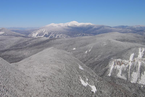
NH 10.0 miles Moderately Difficult many consider the view from the open fire tower platform on Mt. Carrigain to be the finest view in all of the White Mountain National Forest the open views on Signal Ridge are equally fantastic in winter, the hike is 14.0 miles round trip since Sawyer River Road is closed and gated (this adds 2 relatively easy miles of road walking each way tip: you can cross-country ski the road) views of Mt. Washington on a clear day from both Signal Ridge and the summit of Carrigain are outstanding.

snowy views of Mt. Washington from Signal Ridge DIRECTIONS / TRAIL GUIDE
AMC's White Mountain Guide (31st edition)

MOUNT CHOCORUA
STATE TOTAL MILEAGE DIFFICULTY NOTES and HIGHLIGHTS
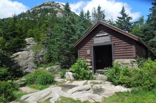
NH Varies, but most popular option is 7.6 miles Moderately Difficult features a big, open rocky summit with more than enough room to fit the massive crowds that usually convene here trails can be found on each face of the mountain, and all are rewarding a first big summit for so many young hikers in New England backcountry lodging available nearby at the Jim Liberty Cabin (see below for picture of summit from the cabin) easiest route to summit is via Champney Falls Trail off the Kancamagus Highway aka NH 112 (this is an out-and-back hike) the best loop is probably Brook Trail > Liberty Trail loop excellent views are also found on the nearby "Sisters" if you have the wiliness to also hike up those peaks while on Chocorua

Jim Liberty Cabin DIRECTIONS / TRAIL GUIDE
AMC's White Mountain Guide (31st edition)

MOUNT GARFIELD
STATE TOTAL MILEAGE DIFFICULTY NOTES and HIGHLIGHTS
NH 10.0 miles Moderately Difficult hike Mt. Garfield to see the beautiful, nearly road-less, panoramic view of the Pemigewasset Wilderness from the summit approach is generally easy with one short but semi-rough section just before the top can be combined with Galehead Mountain for a long but tough loop (short road walk required) backcountry lodging available at the nearby Garfield Ridge Shelter (looks more like a cabin than a shelter) or the AMC Galehead Hut (reservations required) fantastic but long snowshoeing trip in the winter (a road walk of 2.4 miles round-trip is required in winter since the road to the summer parking area is closed and gated).

Mt. Garfield DIRECTIONS / TRAIL GUIDE
AMC's White Mountain Guide (31st edition)

MOUNT HUNGER
STATE TOTAL MILEAGE DIFFICULTY NOTES and HIGHLIGHTS
VT 4.0 miles Moderately Difficult beautiful views of the Stowe area from the summit of this 3,539ft mountain long views of the Green Mountains can also combine with ascent of nearby Stowe Pinnacle, which offers its own fantastic views.

Mt. Hunger DIRECTIONS / TRAIL GUIDE
AMC's White Mountain Guide (31st edition)
Photo Credit: Adam Kavanaugh

MOUNT LINCOLN / MOUNT LAFAYETTE LOOP
STATE TOTAL MILEAGE DIFFICULTY NOTES and HIGHLIGHTS
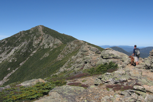
NH 8.8 mile loop Very Difficult most would agree that this is best loop hike in the western side of the White Mountains the classic loop is counterclockwise: Falling Waters Trail > Franconia Ridge Trail > Greenleaf Trail > Old Bridal Path, but you can also do this clockwise as well features several miles of fantastic open ridgeline hiking three waterfalls are seen along the Falling Waters Trail, including the stunning Cloudland Falls do not attempt in foul weather, as many hikers have unfortunately learned this the hard way over the years backcountry lodging available at AMC Greenleaf Hut (reservations required well in advance) trailhead is off I-93 heading north from Lincoln (although you can also park at the parking lots in front of the Lafayette Campground off I-93 heading south and walk under I-93 through a pedestrian tunnel).

Franconia Ridge Trail (looking at Mt. Lincoln) DIRECTIONS / TRAIL GUIDE
AMC's White Mountain Guide (31st edition)

MOUNT MADISON
STATE TOTAL MILEAGE DIFFICULTY NOTES and HIGHLIGHTS
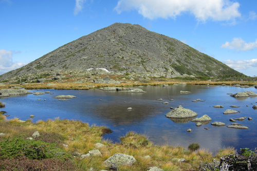
NH Varies, but most common route is 8.4 miles Difficult one of the famed peaks of the Northern Presidentials, Mt. Madison has an alpine summit with 360-degree views lodging available at the AMC Madison Hut (reservations required) don't miss the view of Mt. Madison from Star Lake, which is a short detour from the AMC Madison Hut (see below for picture) most common route is up and down Valley Way, but there are much more attractive approach trails (many with waterfalls) that you can take to bring you up to the AMC Madison Hut, which sits just 0.5 mile below the summit.

Star Lake and Mt. Madison DIRECTIONS / TRAIL GUIDE
AMC's White Mountain Guide (31st edition)

MOUNT MAJOR
STATE TOTAL MILEAGE DIFFICULTY NOTES and HIGHLIGHTS
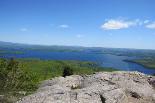
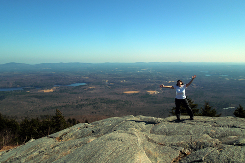
NH 4.0 mile loop Moderately Difficult one of the two best NH lakes-region hikes (the other is West Rattlesnake overlooking Squam Lake), Mt. Major offers a fun climb to dazzling views of many bays and coves two loop options available one of the best "bang for the buck" hikes in New England this is one of those peaks that can turn anybody into a lover of hiking a family-friendly favorite

Mt. Major DIRECTIONS / TRAIL GUIDE
AMC's Southern NH Trail Guide (5th edition)

MOUNT MANSFIELD
STATE TOTAL MILEAGE DIFFICULTY NOTES and HIGHLIGHTS
VT Varies, but most common route is 4.6 miles Difficult Vermont's tallest peak has awesome views and a variety of approach trails the most common route is out-and-back via the Long Trail (4.6 miles round-trip) from the east side of the mountain the Hell Brook Trail > Long Trail loop is a shorter but much steeper option (4.1 miles) the Sunset Ridge Trail loop on the western side of the mountain is perhaps the most scenic route this peak is extremely popular due to hikers and tourists (who arrive via an easy walk from an auto-road and/or a gondola ride) the town of Stowe makes for an excellent base camp for exploring several great mountains in the area (Camel's Hump, Stowe Pinnacle, Mount Hunger).

Mt. Mansfield DIRECTIONS / TRAIL GUIDE
Hiking the Green Mountains
100 Classic Hikes in New England
50 Best Hikes in New England

MOUNT MONADNOCK
STATE TOTAL MILEAGE DIFFICULTY NOTES and HIGHLIGHTS
NH Varies, but most common option is 4.4 lollipop loop Moderately Difficult one of the most famous mountains in the world, Mt. Monadnock is rugged and scenic, all despite its small size (it's not even close to being a 4000-footer) the most common route is a semi-loop up and down the White Dot and White Cross trails, but there are many other less-crowded routes on this mountain (the longest and probably quietest is the Pumpelly Trail) this mountain has lots of interesting nooks and crannies that are closely guarded secrets (the more you read about it and explore the mountain itself, the more you will learn/find about it).

Mt. Monadnock DIRECTIONS / TRAIL GUIDE
AMC's Southern NH Trail Guide (5th edition)

MOUNT WASHINGTON
STATE TOTAL MILEAGE DIFFICULTY NOTES and HIGHLIGHTS
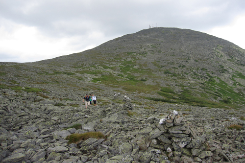
NH Varies, but most common option is an 8.4 mile loop Very Difficult New England's most alpine and tallest mountain is climbed by thousands each year views are absolutely fantastic on all approach trails the most popular route is as follows: Tuckerman's Ravine > Lion's Head Trail loop the mountain is actually a bit easier to hike from the west side as follows: Ammonoosuc Ravine Trail > Jewell Trail loop the Huntington Ravine Trail is the steepest of the approach trails and should not be attempted when icy or wet always be prepared for windy and potentially poor weather on this mountain (it can actually snow any month of the year) many hikers have died on this mountain, so do your research on this mountain before you try to hike it.

Mt. Washington DIRECTIONS / TRAIL GUIDE
AMC's White Mountain Guide (31st edition)

MOUNT WILLARD
STATE TOTAL MILEAGE DIFFICULTY NOTES and HIGHLIGHTS
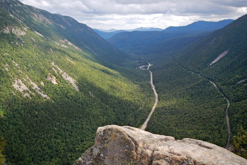
NH 3.2 miles Moderate offers wide, scenic views of Crawford Notch an outstanding adventure for first-time hikers a favorite (and relatively easy) winter snowshoeing trip trailhead begins near the AMC Crawford Notch Depot on US 302 a few miles east of Twin Mountain this is a hike you will likely want to do time and time again this is a great fall foliage hike

Crawford Notch from Mt. Willard DIRECTIONS / TRAIL GUIDE
AMC's White Mountain Guide (31st edition)

PRECIPICE TRAIL
STATE TOTAL MILEAGE DIFFICULTY NOTES and HIGHLIGHTS
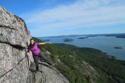
ME 4.0 mile loop Difficult if you like scrambling, you will love ascending the iron rungs and ladders of this invigorating trail this trail is often closed from spring through early August due to nesting peregrine falcons if you enjoy this trail, then also hike the nearby Beehive Trail offers beautiful views of the Atlantic Ocean and other mountains of Acadia National Park start early if you want to avoid crowds and score a parking spot at the trailhead if you have a moderate or strong fear of heights, do NOT do this trail (you've been warned! ) if you have hiked Angel's Landing in Zion National Park in Utah you will likely find this trail comparable in terms of difficulty and enjoyment

Precipice Trail, Acadia National Park DIRECTIONS / TRAIL GUIDE
AMC's Maine Mountain Guide (11th edition)

STOWE PINNACLE
STATE TOTAL MILEAGE DIFFICULTY NOTES and HIGHLIGHTS
VT 2.8 miles Moderately Difficult a bald open summit found within the town of Stowe features great views of the town and a huge chunk of the Green Mountains a family-friend, high "bang-for-the-buck" type of hike you can extend this hike to include hiking Mount Hunger as well trailhead is found on Upper Hollow Road after you have hiked this mountain, go for a swim in Bingham Falls (about 20 minutes away) or check out Moss Glen Falls-Stowe

Stowe Pinnacle DIRECTIONS / TRAIL GUIDE
Hiking the Green Mountains

TRAVELER MOUNTAIN LOOP
STATE TOTAL MILEAGE DIFFICULTY NOTES and HIGHLIGHTS
ME 10.5 mile loop
(estimated)
Difficult this scenic loop in northern Baxter State Park travels over both North Traveler and South Traveler Mountains remote location, but offers some of the best views in this state park this is one of the best hikes to do in the state park after you have hiked Katahdin

Traveler Mountain DIRECTIONS / TRAIL GUIDE
AMC's Maine Mountain Guide (11th edition)
Photo Credit: Kathy Varn Hawkins

WELCH & DICKEY LOOP
STATE TOTAL MILEAGE DIFFICULTY NOTES and HIGHLIGHTS
NH 4.5 mile loop Moderately Difficult located only two hours north of Boston, this loop has fantastic views and is one of the top 10 "bang for the buck" hikes in New England do not hike when wet or icy since the open slabs will be slippery trailhead access is off Orris Road in the town of Thornton (near Waterville Valley) typically snow and ice-free from early May to mid-October a family-friendly favorite arrive early as parking is limited and tickets are now be given out to people who park on the street

Welch and Dickey Loop DIRECTIONS / TRAIL GUIDE
AMC's White Mountain Guide (31st edition)

WEST RATTLESNAKE
STATE TOTAL MILEAGE DIFFICULTY NOTES and HIGHLIGHTS
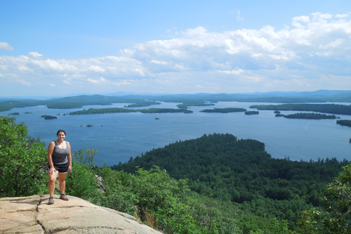
NH 1.8 miles Relatively Easy this hike features some of the finest lake-views to be found anywhere in New England located north of Squam Lake access via the moderately steep Old Bridle Path (out-and-back) photographs never do this place justice, so you'll just have to make a visit yourself closed for most of April and may each year due to "mud season" a fun snowshoe trip (great for beginners) trailhead is across the steet from the Mt. Morgan / Mt. Percival trailhead (located on NH 113 east of I-93)

West Rattlesnake DIRECTIONS / TRAIL GUIDE
AMC's Southern NH Trail Guide (5th edition)

ZEACLIFF
STATE TOTAL MILEAGE DIFFICULTY NOTES and HIGHLIGHTS
NH 7.8 miles Moderately Difficult Zeacliff is one of the top viewpoints in all of New Hampshire this viewpoint is often combined with a hike to the viewless Zealand Mountain (one of the 48 4000-footers of NH) lodging is available at the nearby AMC Zealand Falls Hut (reservations are required well in advance; open year-round) Zeacliff is also a common break/stop along a "Bonds Traverse" hike, which can be done as a day hike (very challenging) or a backpacking trip take note that hiking to Zeacliff require requires an additional 5.0 mile hike in winter as Zealand Road is closed

Zeacliff DIRECTIONS / TRAIL GUIDE
AMC's White Mountain Guide (31st edition)

RUNNER-UPS

Each of the following hikes is a close contender for the 'top 25 hikes' list above. I highly recommend each of these hikes as well. All of these are consistently rated as either excellent or outstanding by guidebook authors.


THE HIKE STATE TOTAL MILEAGE DIFFICULTY NOTES and HIGHLIGHTS
Arethusa Falls NH 3.2 miles Moderately Difficult arguably the finest waterfall in New England;
160-foot tall gorgeous horsetail-style waterfall;
can be combined with nearby Ripley Falls (another 5-star rated waterfall) and/or a hike up Frankenstein Cliffs;
popular with ice climbers in winter (they can be fun to watch);
a great (and relatively safe) snowshoeing adventure in winter;
trailhead is found at the end of Arethusa Falls Road off US 302
Baldpate Mountain ME 8.0 miles
(estimated)
Difficult panoramic views are found on both West Baldplate and East Baldplate;
part of the Grafton Notch Loop trail (eastern section);
en route, two different side trails lead to the top of Table Rock which has its own great views (warning: the side trail closest to ME 26 is extremely steep);
an Adirondack shelter is located between Table Rock and West Baldplate and is available for overnight stay
trailhead on ME 26 in Grafton Notch State Park (Appalachian Trail)
Bash Bish Falls MA 0.8-1.0 miles Easy Massachusetts' most dramatic and probably most-visited waterfall;
80-foot total drop;
located in the far southwest corner of the state of Massachusetts
absolutely gorgeous in early winter;
access to the falls is likely now via a NY 344 (the old MA access road was damaged by a storm in 2013 and may not be reopened yet).
Beehive, The ME 1.3 miles Moderately Difficult very fun scrambling on metal rungs and ladders in Acadia National Park;
unobstructed Atlantic Ocean views as you climb and from the top;
you can easily extend this hike as there is a massive trail network in this area (refer to an Acadia National Park hiking trail map to see all your options);
if you enjoy the challenge of this trail, try the nearby and more-intense Precipice Trail (assuming it is open - it's usually closed from May through early August);
trailhead on Park Loop Road (eastern side) within Acadia National Park
Bridal Veil Falls NH 5.0 miles Easy but long one of the loveliest (and easiest) half-day hikes in New Hampshire;
a beautiful waterfall is found at the end of the overall very gentle Coppermine Trail;
try to find the plaque that Bette Davis placed on a boulder in the river after she was saved by a local resident after she got lost (if you can find it);
a (free) lean-to is 0.2 mile below the falls for those that want to stay out overnight;
makes a great snowshoeing or backcountry cross-country skiing route in winter
Cadillac Mountain ME Varies, but shortest option is 2.8 miles Moderately Difficult the tallest point in Acadia National Park has gorgeous views (just make sure to go a little bit off-trail to avoid the crowds that drive up the auto road);
several different route options exist to hike this peak (including the South Ridge Trail that starts right at the Blackwoods Campground);
beautiful sunrises and sunsets if you are willing to hike at night (bring headlamps), or you can just drive the top for this
Doubletop Mountain ME 6.0 miles Moderately Difficult one of the top hikes in Baxter State Park;
above-treeline views of Katahdin and much of Baxter State Park;
Gulf Hagas ME 8.6 miles Moderately Difficult commonly referred to as 'The Grand Canyon of Maine';
several excellent waterfalls and swimming holes on 8.6 mile loop;
great campsites are nearby (reserve well in advance; see northmainewoods.org for detail)
access via Katahdin Iron Works Rd off ME 11 a (fee required, and honestly it's a bit expensive for out-of-state residents, so be prepared for that);
includes one river crossing that is often ankle deep (avoid in high water);
Hamlin Peak ME 10.8 miles
(including Katahdin)
Very Difficult alpine views of Katahdin and much of the rest of Baxter State Park;
often combined with Katahdin as part of a long and very-tough day hiking loop;
Hamlin can also be done as an overnight hike by staying at Chimney Pond (lean-tos are available with advance reservation);
parking permits required in advance (reserve several weeks in advance);
Kearsarge North NH 6.2 miles Moderately Difficult gorgeous views of the eastern White Mountains from the empty but enclosed fire tower on the summit;
access via traillhead on Hurricane Road a few miles north of downtown North Conway;
ledges can be difficult when icy or wet;
one of the finest 1/2 day hikes in the White Mountains;
a very popular snowshoe hike in winter (the road and trailhead are usually plowed quickly after snowstorms);
Marginal Way ME 2.0 miles Easy one of the finest coastal walks in New England;
connects Ogunquit Beach and Perkins Cover
limited parking, so get there early and/or go in the off-season
Mount Abraham ME 8.0 miles
(estimate)
Moderately Difficult alpine mountain with fantastic views;
access can be tricky and depends upon state of logging roads and bridges;
perform an internet search on the current status of the logging roads before trying to hike this mountain;
Mount Abraham VT 5.2 miles Moderately Difficult 360-degree views from one of Vermont's five 4000-footers;
can extend hike to include Lincoln Peak and even Mt. Ellen (another one of Vermont's 4000-footers);
Mount Crawford NH 5.0 miles Moderately Difficult near-360-degree views from open summit;
access via Davis Path trailhead on US 302;
moderate but fun snowshoeing hike in winter (as conditions allow);
Mount Eisenhower NH 6.6 miles Moderately Difficult excellent 360-degree views from bald summit, including some of Presidential Range peaks;
a huge cairn marks the summit;
an excellent first 'above treeline' hike/mountain for novice hikers;
access via Edmunds Path off Mt. Clinton Road (closed in winter);
typically snow and ice-free from late-May to early October;
Mount Greylock MA Varies based on upon route Moderately Difficult Mt. Greylock is the tallest peak in Massachusetts;
views can be found all over this mountain, including from broad ledges along its edges and at the summit itself;
a historic lodge and memorial tower exist at the summit (reservations required);
many different routes and loop options available on this 3,491ft mountain;
Thunderbolt Ski Trail is a fantastic backcountry ski route in winter;
Mount Hight / Carter Dome NH 10.0 miles Moderately Difficult bag a 4000-footer (Carter Dome) and one of the best views in the White Mountain (Mt. Hight) on a "lollipop loop" hike;
overnight lodging available year-round at the AMC Carter Notch Hut (reserve months in advance)
Mount Jefferson NH 5.0 miles Difficult one of the northern Presidential-Range peaks;
the most common route up this peak is via the scrambly Caps Ridge Trail off Jefferson Notch Road (5.0 miles round-trip), but there are other alternative routes to the summit from other trailheads;
360-degree alpine views;
some scrambling involved on nearly all routes;
typically snow and ice-free from late May to early October;
Mount Liberty and Mount Flume NH 9.8 miles Difficult open views from both summits;
you can either do a 9.8 mile loop over both summits (but you'll have to scramble up the very steep and dangerous-when-wet Flume Slide Trail) or you can do a 10.2 mile out-and-back hike up Mt. Liberty and scoot over to Mt. Flume (return the way you came);
backcountry tent sites available at Liberty Springs tent site (a fee is charged and the sites can fill up quickly);
Mount Moosilauke NH 7.5 miles Difficult one of the most famous of NH's 4000-footers;
wide open alpine views;
several different route options available;
the easiest route up this mountain is the 7.5 mile loop up Gorge Brook and returning via Carriage Road and Snapper Trail (start at the Moosilauke Ravine Lodge)
a more interesting route to this summit is via the steep but waterfall-infused Beaver Brook Trail;
do not attempt this mountain in poor weather as there is substantial above-treeline terrain;
Mount Osceola (from Tripoli Road) NH 6.4 miles Moderately Difficult a spacious, flat ledge near the summit offers outstanding 180-degree views;
easiest access to this '4000-footer' is via the Mt. Osceola Trail from Tripoli Road (open seasonally and can be accessed from either Waterville Valley/NH-49 or from I-93);
often combined with nearby but viewless East Osceola Peak (which is another 4000-footer);
Mount Pisgah VT 3.8 views Moderately Difficult lofty views of Willoughby Lake, one of the most scenic bodies of water in New England;
a vastly underrated hike since this section of Vermont isn't heavily visited;
Mount Race and Race Brook Falls MA 6.75 miles Moderately Difficult ridgeline views and five noteworthy tiers of excellent waterfalls and cascades;
with a (long) carspot, you can extend this hike into a fabulous traverse;
several backcountry official campsites are available for use (including Race Brook tent site);
Moxie Falls ME 1.2 miles Easy Maine's finest waterfall (5/5 stars!);
90-foot tall drop with additional cascades above and below;
popular with tourists who are staying in the area to go whitewater rafting on either the Kennebec River or Dead River;
easy access via marked trailhead on Lake Moxie Road;
North Brother Mountain ME 9.0 miles Moderately Difficult one of the finest hikes in Baxter State Park;
one of Maine's 4000-footers (4,143ft tall);
can also extend hike to include Mt. Coe and South Brother;
North Moat Mountain NH 10.2 mile loop or 9.7 mile traverse Difficult one of the finest hikes in the Eastern White Mountains
don't miss swimming or splashing in Diana's Baths on the way down
trailhead is shared with Diana's Baths Trailnead in North Conway
if you have two vehicles, you can do a 9.7 mile traverse over all three Moats (North, Middle & South); start at the Diana's Baths trailhead and end at the trailhead on Dugway Road
North Moat has the finest views of all three Moats (360-degree unobstructed views);
Owl, The ME 6.0 miles Moderately Difficult excellent Baxter State Park views;
visited far less often than most other Baxter peaks;
parking permit required (reserve online for the Hunt Trailhead several weeks in advance);
Penobscot and Sargent Mountain ME 4.5 miles Moderately Difficult consistently excellent mountain and ocean views;
one of the finest hikes in Acadia National Park;
can easily extend hike with network of highly worthwhile trails in the area (consult an Acadia National Park map, such as this one;
Percy Peaks NH 4.0 miles (estimated) Moderately Difficult an off the beaten-path "North Woods" area hike;
involves scrambling on ledges, which are dangerous when wet and/or icy;
trailhead is off Nash Stream Road, which is closed in winter;
Pine Mountain NH 3.5 miles Moderately Difficult awesome views for the effort involved;
popular with campers staying at the huge Dolly Copp Campground;
the typical way to climb this mountains is via the Pine Link Trail trailhead on Pinkham B Road;
can also be climbed via a trail that begins near downtown Gorham;
involves a rather long but easy road-walk on a private road (hikers are welcome);
Saddleback Mountain and The Horn ME 13.5 miles
(estimated)
Difficult some of the finest views in Maine;
lots of alpine terrain;
several backcountry camping options;
South Twin / North Twin NH 11.2 miles Difficult good views en route from North Twin Mountain and there are awesome 360-degree views from the open summit of South Twin;
difficult river crossings when water is running high;
backcountry lodging is available at nearby AMC Galehead Hut (make reservations months in advance)
trailhead is on Haystack Road (closed in winter)
Stratton Mountain and Stratton Pond VT 11.0 miles Difficult visit a backcountry pond (a shelter and tent sites are available for those that want to stay overnight);
one of Vermont's finest views is from the fire tower atop Stratton Mountain;
Table Rock NH 1.4 miles Difficult steep trail to ledgy view in Dixville Notch;
don't miss two nearby waterfalls while in the Dixville Notch area: Huntington Cascades and Dixville Flume
Tumbledown Mountain ME 4.0 miles
(estimated)
Difficult scenic views, open ridges, fun rock scrambling, and an attractive backcountry pond;
Webster Cliff Trail / Mt. Webster NH 6.6 miles Moderately Difficult trailhead is on US 302 southeast of the AMC Highland Center in Crawford Notch
several open views from the ledges on the side of Mt. Webster provide probably the finest views of Crawford Notch;
with a carspot, you can easily extend this hike add Mt. Jackson (scenic views), Mizpah Hut (overnight lodging) and even Mt. Pierce (scenic views) to the hike;
White Cap Mountain ME 4.2 miles Difficult extremely remote location in the Maine North Woods;
access is via remote logging roads, which have road conditions that can change unpredictably (4WD and/or high-clearance may be required);

OTHER LISTS BY NEWENGLANDWATERFALLS.COM

Here are some more lists to help you enjoy the awesome hiking trails of New England:
  • Top 10 Hikes in the White Mountains of NH = link
  • Top 25 Hikes in the White Mountains of NH = link
  • Top 25 Hikes in New Hampshire = link
  • Top 25 Easy Day Hikes in New England = link
  • Top 25 Loop Hikes in New England = link
  • Top 25 Family-Friendly Hikes in New England = link
  • Rock Scrambling in New England = link
  • Hiking New Hampshire's 4000-Footers = link
  • Hiking New Hampshire's 52 Peaks With A View List = link
  • Hiking New Hampshire's Terrifying 25 List = link
  • Hiking the North Shore of Massachusetts / North of Boston = link
EXPLORE MORE OF NEW ENGLAND!
Connecticut /  Maine /  Massachusetts /  New Hampshire  /  Rhode Island  /  Vermont
Home Page /  About the Book /  Book Updates /  Top 40 Waterfalls /  Swimming Holes /  How To Use This Guide /  Contact Us
Waterfall Photography /  Top 25 New England Hikes /  4000 Footers of NH /  Bigroads.com

© newenglandwaterfalls.com
photographs/images may not be used without permission
Waterfalls, swimming holes, and hiking can be extremely dangerous. Hundreds of people have been injured or killed in the waterfalls and swimming holes of New England over the years. Never swim in strong water currents. Don't jump into a swimming hole without scouting it first. Do not climb up or along the side of waterfalls. Be wary of slippery rocks. Never swim in pools above waterfalls. Use of this website and all of its information is at your own risk! Newenglandwaterfalls.com will not be held liable for your actions. Be safe out there - and always use common sense!

As an Amazon Associates affiliate, this website contains affiliate links. If you choose to purchase any products after clicking any links, I may receive a commission at no extra cost to you. I only endorse products that I have personally used or come highly recommended by trusted peers.