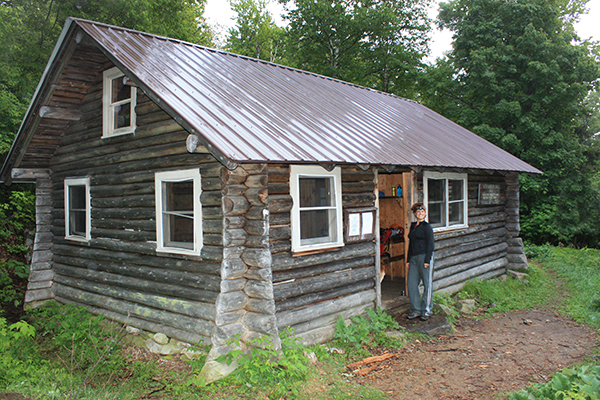
HIKING THE 52-WITH-A-VIEW LIST (52 WAV)
Welcome to the Newenglandwaterfalls.com guide to hiking New Hampshire's 52-With-A-View list!
A group called the Over the Hill Hikers created the 52-With-A-View ('52 WAV') club as a way to draw attention to New Hampshire's great peaks that have an elevation either close to or above 2,500 feet in elevation. The idea was to create a new hiking list that would compliment the New Hampshire 4000-footers list. The idea caught on, and now hundreds of hikers have now completed this special journey.
After you hike all 52 mountains on the list, you can apply for a patch to formally acknowledge your achievement. Information on applying for the patch can be found here.
If your plan is to hike the 52 WAV, I highly recommend that you pick up a copy of each of these three great guidebooks:
AMC: White Mountain Guide (31st edition)
New Hampshire's 52 With a View: A Hiker's Guide (2nd edition)
Follow New England Waterfalls on Facebook! 
PEAK
(summit elevation) |
LOCATION |
OVERALL VIEW / SCENIC RATING |
LEVEL OF DIFFICULTY
(of the easiest route; see below for route) |
CROWD
LEVEL |
TRAIL INFO / TRAIL MAPS |
AVALON
(3,442 feet) |
US 302 / Crawford Notch |
9
(Excellent) |
Moderate |
Moderate / High |
AMC White Mountain Guide (31st edition)
|
BALDFACE, NORTH
(3,610 feet) |
NH 113 / Evans Notch |
10
(Outstanding) |
Very Difficult |
High |
AMC White Mountain Guide (31st edition)
|
BALDFACE, SOUTH
(3,570 feet) |
NH 113 / Evans Notch |
10
(Outstanding) |
Very Difficult |
High |
AMC White Mountain Guide (31st edition)
|
BALD PEAK
(2,465 feet) |
NH 116 / Easton |
8
(Great) |
Moderate |
Moderate |
AMC White Mountain Guide (31st edition)
|
BLACK-Benton
(2,830 feet) |
Lime Kiln Road / Benton |
10
(Outstanding) |
Moderate |
Moderate |
AMC White Mountain Guide (31st edition)
|
CARDIGAN
(3,155 feet) |
Alexandria & Orange
(several different trailheads) |
10
(Outstanding) |
Moderate |
Extremely High |
AMC Southern NH Trail Guide (5th edition) |
CHOCORUA
(3,500 feet) |
NH 112 & NH 16 / Albany (several different trailheads) |
10
(Outstanding) |
Difficult |
Extremely High |
AMC White Mountain Guide (31st edition)
|
CRAWFORD
(3,119 feet) |
US 302 / Crawford Notch |
9
(Excellent) |
Moderate / Difficult |
High |
AMC White Mountain Guide (31st edition)
|
CUBE
(2,909 feet) |
NH 25A / Orford |
9
(Excellent) |
Moderate / Difficult |
Low |
AMC White Mountain Guide (31st edition)
|
DOUBLEHEAD: NORTH & SOUTH
(3,053 & 2,939 feet) |
Dundee Road / Jackson |
8
(Great) |
Moderate |
Moderate |
AMC White Mountain Guide (31st edition)
|
EAGLE CRAG
(3,030 feet) |
NH 113 / Evans Notch |
7
(Good) |
Difficult / Very Difficult |
Low |
AMC White Mountain Guide (31st edition)
|
EASTMAN
(2,939 feet) |
NH 113 / Evans Notch |
5
(Poor/Fair) |
Moderate but long |
Low |
AMC White Mountain Guide (31st edition)
|
HAYES
(2,555 feet) |
Hogan Road / US 2 / Gorham |
8
(Great) |
Moderate |
Low |
AMC White Mountain Guide (31st edition)
|
HEDGEHOG
(2,532 feet) |
NH 112 / Kancamagus Highway |
8
(Great) |
Moderate |
Moderate |
AMC White Mountain Guide (31st edition)
|
HORN
(3,905 feet) |
Mill Brook Road or York Pond Road / Berlin |
6
(Good) |
Difficult |
Low |
AMC White Mountain Guide (31st edition)
|
IMP FACE
(3,165 feet) |
NH 16 / Pinkham Notch |
8
(Great) |
Moderate |
Moderate / High |
AMC White Mountain Guide (31st edition)
|
IRON MOUNTAIN
(2,723 feet) |
Iron Mountain Road / Jackson |
8
(Great) |
Moderate |
Low |
AMC White Mountain Guide (31st edition)
|
ISRAEL
(2,630 feet) |
Diamond Ledge Road / Sandwich |
8
(Great) |
Moderate |
Low |
AMC White Mountain Guide (31st edition)
|
JENNINGS
(3,460 feet) |
NH 49 / Waterville Valley
|
9
(Excellent) |
Difficult |
Low |
AMC White Mountain Guide (31st edition)
|
KEARSARGE
(2,930 feet) |
Winslow State Park & Rollins State Park / Warner |
9
(Excellent) |
Easy / Moderate |
Extremely High |
AMC Southern NH Trail Guide (5th edition) |
KEARSARGE NORTH
(3,268 feet) |
Hurricane Mountain Road / North Conway |
9
(Excellent) |
Moderate / Difficult |
High |
AMC White Mountain Guide (31st edition)
|
MAGALLOWAY
(3,383 feet) |
spur dirt road off Magalloway Road / Pittsburg |
9
(Excellent) |
Easy / Moderate |
Low |
50 Hikes North of the White Mountains |
MOAT, NORTH
(3,196 feet) |
Dugway Road or West Side Road / North Conway |
10
(Outstanding) |
Difficult / Very Difficult |
Moderate |
AMC White Mountain Guide (31st edition)
|
MOAT, SOUTH
(2,770 feet) |
Dugway Road or West Side Road / North Conway |
10
(Outstanding) |
Difficult |
Moderate |
AMC White Mountain Guide (31st edition)
|
MONADNOCK
(3,165 feet) |
Mount Monadnock State Park / Jaffrey & Dublin |
10
(Outstanding) |
Moderate |
Extremely High |
AMC Southern NH Trail Guide (5th edition) |
MORGAN
(2,220 feet) |
NH 113 / Squam Lakes Region |
9
(Excellent) |
Moderate |
High |
AMC Southern NH Trail Guide (5th edition) |
OWL'S HEAD
(3,258 feet) |
NH 115 / Carroll (north of Twin Mountain) |
8
(Great) |
Difficult |
Moderate |
AMC White Mountain Guide (31st edition)
|
PARKER
(3,004 feet) |
Cobb Farm Road / US 302 / Crawford Notch |
8
(Great) |
Difficult |
Low |
AMC White Mountain Guide (31st edition)
|
PAUGUS
(3,198 feet) |
NH 113A / Wonalancet |
8
(Great) |
Difficult |
Low |
AMC White Mountain Guide (31st edition)
|
PEMIGEWASSET
(2,557 feet) |
US 3 / Franconia Notch |
9
(Excellent) |
Moderate |
Moderate / High |
AMC White Mountain Guide (31st edition)
|
PERVICAL
(2,212 feet) |
NH 113 / Squam Lakes Region |
8
(Great) |
Moderate |
High |
AMC Southern NH Trail Guide (5th edition) |
PERCY, NORTH
(3,430 feet) |
Nash Stream Road / NH 110 / Stafford |
10
(Outstanding) |
Moderate |
Low |
AMC White Mountain Guide (31st edition)
|
PINE
(2,404 feet) |
NH 16 / Gorham |
9
(Excellent) |
Moderate |
Moderate |
AMC White Mountain Guide (31st edition)
|
POTASH
(2,680 feet) |
NH 112 / Kancamagus Highway |
8
(Great) |
Moderate |
Moderate |
AMC White Mountain Guide (31st edition)
|
RESOLUTION
(3,415 feet) |
US 302 / Crawford Notch |
7
(Good/Great) |
Difficult |
Moderate |
AMC White Mountain Guide (31st edition)
|
ROBERTS
(2,582 feet) |
NH 171 / Castle in the Clouds / Moultonborough |
9
(Excellent) |
Moderate |
Moderate |
AMC Southern NH Trail Guide (5th edition)& the LRCT Map |
ROGER'S LEDGE
(2,965 feet) |
NH 110 / Berlin |
9
(Excellent) |
Moderate / Difficult |
Low / Moderate |
AMC White Mountain Guide (31st edition)
|
SANDWICH DOME
(3,980 feet) |
NH 49 / Waterville Valley |
7
(Good) |
Difficult |
Moderate |
AMC White Mountain Guide (31st edition)
|
SHAW
(2,990 feet) |
NH 171 / Castle in the Clouds / Moultonborough |
8
(Great) |
Moderate / Difficult |
Low |
AMC Southern NH Trail Guide (5th edition)& the LRCT Map |
SHELBURNE MORIAH
(3,735 feet) |
US 2 / Shelburne |
8
(Great) |
Difficult |
Low |
AMC White Mountain Guide (31st edition)
|
SISTER, MIDDLE
(3,340 feet) |
NH 112 & NH 16 / Albany |
10
(Outstanding) |
Difficult / Very Difficult |
Moderate |
AMC White Mountain Guide (31st edition)
|
SMARTS
(3,238 feet) |
Lyme-Dorchester Rd / Lyme |
10
(Outstanding) |
Difficult |
Low |
AMC White Mountain Guide (31st edition)
|
STAIRS
(3,463 feet) |
US 302 / Crawford Notch |
8
(Great) |
Difficult |
Moderate |
AMC White Mountain Guide (31st edition)
|
STINSON
(2,900 feet) |
Lower Doe Town Road / Rumney |
8
(Great) |
Moderate |
Low |
AMC White Mountain Guide (31st edition)
|
SUCCESS
(3,565 feet) |
Success Pond Road / Berlin |
8
(Great) |
Moderate / Difficult |
Low |
AMC White Mountain Guide (31st edition)
|
SUGARLOAF-Stratford
(3,710 feet) |
Nash Stream Road / NH 110 / Stratford |
8
(Great) |
Moderate |
Low |
AMC White Mountain Guide (31st edition)
|
SUGARLOAF-Twin Mtn
(2,539 feet) |
Zealand Road / US 302 / Twin Mountain |
9
(Excellent) |
Moderate |
High |
AMC White Mountain Guide (31st edition)
|
TABLE
(2,610 feet) |
Bear Notch Road |
7
(Good/Great) |
Moderate |
Moderate |
AMC White Mountain Guide (31st edition)
|
TREMONT
(3,371 feet) |
US 302 / Bartlett |
8
(Great) |
Moderate / Difficult |
Low |
AMC White Mountain Guide (31st edition)
|
WEBSTER
(3,910 feet) |
US 302 / Crawford Notch |
9
(Excellent) |
Moderate / Difficult |
High |
AMC White Mountain Guide (31st edition)
|
WELCH & DICKEY
(2,734 feet) |
Orris Rd / NH 49 / Waterville Valley |
10
(Outstanding) |
Moderate |
Extremely High |
AMC White Mountain Guide (31st edition)
|
WILLARD
(2,865 feet) |
US 302 / Crawford Notch |
9
(Excellent) |
Easy / Moderate |
Extremely High |
AMC White Mountain Guide (31st edition)
|
Take note that there are several peaks that were on the 52 With-A-View list at some point, but have since been removed. This includes:
- Black Mountain in Jackson was replaced in 2020.
- Blueberry Mountain in Benton was replaced in 2025 by Bald Peak in Easton.
- Hibbard was replaced in 2020.
- Iron Mountain was replaced in 2020, but added back in 2025 after a trail re-routing.
- Mount Carr was replaced by Black Mountain (Jackson) in 2001.
- Mount Martha was replaced in 2025 by Owlshead.
- Mount Wolf was replaced by Mt. Roberts in 2010.
- Square Ledge was replaced in 2020.
- Starr King was replaced in 2025.
- West Royce was replaced in 2020.
In the future, there is the potential for new peaks to be added to this list as a few of the existing peaks have lost a significant amount of their views over the years due to tree growth.
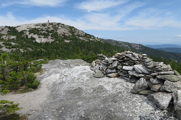
view of the main summit of Mt. Cardigan as seen from the south summit
TIPS FOR HIKING THE 52 WITH-A-VIEW LIST
- BUG SEASON - I recommend avoiding hiking the 52 WAV in New Hampshire from late-May through early July. This is black fly season and they can be absolutely intolerable (think Alaskan mosquito-level bad). You can try to use bug spray or DEET-based products, but they don't always work well for all people. If you absolutely must hike during this time-frame, do yourself a favor and consider getting a wide-brimmed hat and a mesh bug net.
- TRAIL CONDITIONS - Review trailsnh.com to obtain the latest in trail conditions (especially in winter and early spring, when snow & ice conditions can be highly variable). Recent reviews on AllTrails are also often helpful.
- READ GUIDEBOOKS - Buy the revelent hiking guidebooks and actually read each relevant chapter before you take your hiking trip. You'll understand potential dangers and also make sure you don't miss any scenic views or other interesting diversions along the way.
- USE TREKKING POLES - Save your knees so that you can still hike when you are in your 70's (tip: use trekking poles 100% of the time).
- LEAVE A NOTE - Always leave a note or tell someone which trails and mountains you will be hiking (too many people get lost and/or injured in the mountains of New Hampshire).
- BEWARE OF BREAK-INS - Don't leave anything valuable in your car (unfortunately, too many break-ins have occurred in New Hampshire).
- GET CREATIVE - Learn the value of hitch-hiking, using a car-spot, and/or mountain biking between trailheads (note: a traverse is almost always more interesting than an out-and-back hike).
- START HIKING EARLY - Start your hikes early (i.e. before 7:30am) to beat most of the crowds on the popular peaks.
- REVIEW MAPS - Study hiking maps because they can help you become creative in the routes you take. You don't always have to take the easiest or most-straightforward trails.
- HIKE IN SEPTEMBER - Mid-week September hiking is amazing. Hike at least once during this time-frame (call out sick from work if you have to).
- CARRY APPROPRIATE FOOD - Carry the appropriate type and amount of food based on the season you are hiking in (some foods will melt in summer, and some foods become rock-solid in winter) and the length of your hike.
- REFUEL - Attack some great local restaurants after at least some of the hikes (or all of them). You've earned it. In the White Mountains of New Hampshire, many of the best restaurants are found in the towns of North Conway, Jackson, Lincoln and Woodstock.
- GET AN REI MEMBERSHIP - Purchase a lifetime REI membership to save 8-10% on all full-price REI purchases. Also, strongly consider applying for the REI credit card (you can earn hundreds of dollars in dividends each year if you use this credit card as your primary card for your non-REI purchases).
- BLUEBIRD DAYS - Do the great mountains on the bluebird days, and the less interesting mountains on the overcast or lousy-weather days.
- PEAK FOLIAGE - Don't miss hiking some of the 52 WAV during peak fall foliage in early October.
- GET SOME ELECTROLYTES - Bring some Gatorade (or something similar) to get some electrolytes into your system.
- VITAMIN I - Ibuprofen can be extremely helpful in controlling pain and/or reducing swelling. Use sparingly though.
- ADVERSE WEATHER - New Hampshire's mountains can be nasty (even deadly) in adverse weather conditions. Snow and ice can also be very problematic, sometimes as early as early October and often extending well into May.
- WILDERNESS FIRST AID - Take a wilderness first aid course to prepare you in case something goes wrong.
- CATCH A SUNRISE OR SUNSET - Catch a sunset or sunrise from a mountain top or above treeline (bring at least one headlamp to help you get down safely).
- TREAT WATER - Always treat water before drinking it (use iodine, boil, or use a filter). You don't want to risk catching giardia, even though many hikers believe the risk of catching it in moving streams is relatively low.
- BRING A REAL CAMERA - Don't forget your camera, and remember to label the pictures after you are done with each hike (you'll want to capture these moments). A DSLR or mirrorless camera is recommended instead of taking pictures with your smartphone. The reason is because the camera resolution on your smart-phone probably won't look great on tablet and computer monitors 10 or 20 years from now.
- AMC WHITE MOUNTAIN GUIDE - The AMC White Mountain Guide (31st Edition) literally describes every single trail in the White Mountains. There are no pictures in this guidebook, but it's the finest and most accurate hiking guidebook on the planet. In fact, it's widely known as the 'Hikers Bible' for the White Mountains region.
- ROAD STATUS - Keep abreast as to which roads in the White Mountain National Forest roads are currently closed. The rangers maintain a road status log here (although it is not always updated timely and it may redirect you to their Facebook page).
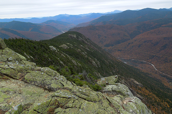
view from the Webster Cliff Trail south of the summit of Mt. Webster
STANDARD HIKING ROUTES
Here are the most common routes used to hike each of the 52 WAV, along with their mileage and elevation gain. However, please keep in mind that many of these peaks offer one (or more) alternate trails, some of which offer better scenery and/or fewer crowds than the standard route.
- AVALON = US-302 trailhead > Avalon Trail > short spur trail to summit
---------------------------------------------------------------------------------------------------------------------------------------------
- BALDFACE, NORTH = US-113 trailhead > Baldface Circle Trail > South Baldface summit > Baldface Circle Trail > North Baldface summit > Baldface Circle Trail > end; consider also adding Eagle Crag (adds 0.2 mile round trip)
- 9.8 mile clockwise loop; 3,600ft gain; very difficult
- Full trail descriptions can be found in the 2nd edition of the New Hampshire's 52 With a View guidebook
---------------------------------------------------------------------------------------------------------------------------------------------
- BALDFACE, SOUTH = US-113 trailhead > Baldface Circle Trail > South Baldface > Baldface Circle Trail > North Baldface > Baldface Circle Trail > end; consider also adding Eagle Crag (adds 0.2 mile round trip)
- 9.8 mile clockwise loop; 3,600ft gain; very difficult
- Full trail descriptions can be found in the 2nd edition of the New Hampshire's 52 With a View guidebook
---------------------------------------------------------------------------------------------------------------------------------------------
- BALD PEAK = NH-116 trailhead > summit
- 4.2 miles round-trip; 1,350ft gain; moderate
- The trail continues to eventually climb the Kinsmans (two 4000-footers)
---------------------------------------------------------------------------------------------------------------------------------------------
- BLACK-Benton = Lime Kiln Road trailhead > Chippewa Trail > summit
---------------------------------------------------------------------------------------------------------------------------------------------
- BLUEBERRY-Benton = Long Pond Road trailhead > Blueberry Mountain Trail > summit
---------------------------------------------------------------------------------------------------------------------------------------------
- CARDIGAN = there are a half-dozen popular ways to climb this mountain, but here are the two standard routes:
- From the West: Mount Cardigan State Park trailhead > West Ridge Trail > summit
- 3.0 miles round-trip; 1,250ft gain; moderate
- From the East: AMC Cardigan Lodge Trailhead > Manning Trail > Holt Trail > Holt-Clark Cutoff > Clark Trail > Mt. Cardigan summit > Mowglis Trail > Manning Trail > end
- 5.5 mile loop; 1,950ft gain; moderate/difficult
- Full trail descriptions can be found in the 2nd edition of the New Hampshire's 52 With a View guidebook
---------------------------------------------------------------------------------------------------------------------------------------------
- CHOCORUA = there are a half-dozen popular ways to climb this mountain, but here are the two standard routes:
- From the North: Kancamagus Highway trailhead > Champney Falls Trail > Piper Trail > summit
- 7.6 miles round-trip; 2,300ft gain; difficult
- From the East: Piper Trail Road trailhead > Piper Trail > summit
- 8.6 miles round-trip; 2,700ft gain; difficult/very difficult
- Full trail descriptions can be found in the 2nd edition of the New Hampshire's 52 With a View guidebook
---------------------------------------------------------------------------------------------------------------------------------------------
- CRAWFORD = US-302 trailhead > Davis Path > spur trail to summit
- 5.0 miles round-trip; 2,100ft gain; moderate/difficult
- Full trail descriptions can be found in the 2nd edition of the New Hampshire's 52 With a View guidebook
---------------------------------------------------------------------------------------------------------------------------------------------
- CUBE = NH25A trailhead > Appalachian Trail > summit
- 6.8 miles round-trip; 2,100ft gain; moderate/difficult
- Full trail descriptions can be found in the 2nd edition of the New Hampshire's 52 With a View guidebook
---------------------------------------------------------------------------------------------------------------------------------------------
- DOUBLEHEAD, NORTH & SOUTH = Dundee Road trailhead > Doublehead Ski Trail > Doublehead Cabin > spur trail to views behind Doublehead Cabin > Old Path > New Path > South Doublehead summit > New Path > short road walk > end
- 4.0 mile clockwise loop; 1,800ft gain; moderate
- Full trail descriptions can be found in the 2nd edition of the New Hampshire's 52 With a View guidebook
---------------------------------------------------------------------------------------------------------------------------------------------
- EAGLE CRAG = this summit is typically added as part of a loop over the Baldfaces
- 10.0 mile clockwise loop; 3,650ft gain, including both Badlfaces and Eagle Crag; difficult / very difficult
- Full trail descriptions can be found in the 2nd edition of the New Hampshire's 52 With a View guidebook
---------------------------------------------------------------------------------------------------------------------------------------------
- EASTMAN = Slippery Brook Road trailhead > Slipper Brook Trail > Eastman Mountain Trail > summit
- 9.3 miles round-trip; 1,600ft gain; moderate but long
- Full trail descriptions can be found in the 2nd edition of the New Hampshire's 52 With a View guidebook
---------------------------------------------------------------------------------------------------------------------------------------------
- HAYES = Hogan Road trailhead > Mahoosuc Trail > summit
---------------------------------------------------------------------------------------------------------------------------------------------
- HEDGEHOG = NH-112 trailhead > UNH Trail > summit > UNH Trail > end
- 4.8 mile counterclockwise loop; 1,350ft gain; moderate
- Full trail descriptions can be found in the 2nd edition of the New Hampshire's 52 With a View guidebook
---------------------------------------------------------------------------------------------------------------------------------------------
- HORN = this mountain is most commonly hiked with Mt. Cabot (a 4000-footer) via the following loop: York Pond Road trailhead > York Pond Trail > Bunnell Notch Trail > Kilkenny Ridge Trail > Mt. Cabot summit > Kilkienny Ridge Trail > spur to The Horn > The Horn summit > spur to The Horn > Kilkenny Ridge Trail > Uknown Pond Trail > short roadwalk > end
- 11.0 mile clockwise loop; 2,900ft gain; difficult/very difficult
- Full trail descriptions can be found in the 2nd edition of the New Hampshire's 52 With a View guidebook
---------------------------------------------------------------------------------------------------------------------------------------------
- IMP FACE = NH-16 trailhead > Imp Trail > summit
---------------------------------------------------------------------------------------------------------------------------------------------
IRON MOUNTAIN = Iron Mountain Road trailhead > Iron Mountain Trail > summit > south cliffs
- Estimated 4.4 miles round-trip after recent trail work; 850ft gain; moderate
---------------------------------------------------------------------------------------------------------------------------------------------
- ISRAEL = Diamond Ledge Road trailhead > Wentworth Trail > summit
---------------------------------------------------------------------------------------------------------------------------------------------
- JENNINGS = this mountain is most commonly hiked with Sandwich Dome via the following semi-loop: NH 49 trailhead > Sandwich Mountain Trail > short spur trail to Jennings Peak > Sandwich Mountain Trail > Sandwich Dome summit > Sandwich Mountain Trail > Drakes Brook Trail > end
- 8.4 mile counter-clockwise semi-loop; 2,600ft gain; difficult
- Full trail descriptions can be found in the 2nd edition of the New Hampshire's 52 With a View guidebook
---------------------------------------------------------------------------------------------------------------------------------------------
- KEARSARGE = Winslow State Park trailhead > Barlow Trail > summit > Winslow Trail > end
- 2.8 mile clockwise loop; 1,100ft gain; easy/moderate
- Full trail descriptions can be found in the 2nd edition of the New Hampshire's 52 With a View guidebook
---------------------------------------------------------------------------------------------------------------------------------------------
- KEARSARGE NORTH = Hurricane Mountain Road trailhead > Mount Kearsarge North Trail > summit
- 6.2 miles round-trip; 2,600ft gain; moderate/difficult
- Full trail descriptions can be found in the 2nd edition of the New Hampshire's 52 With a View guidebook
---------------------------------------------------------------------------------------------------------------------------------------------
- MAGALLOWAY = spur dirt road off Magalloway Road > Coot Trail > summit
- 1.8 miles round-trip; 800ft gain; easy/moderate
- Full trail descriptions can be found in the 2nd edition of the New Hampshire's 52 With a View guidebook
---------------------------------------------------------------------------------------------------------------------------------------------
- MOAT, NORTH = West Side Road trailhead (limited parking, get there before 8:30am) > Moat Mountain Trail > Red Ridge Trail > Moat Mountain Trail > North Moat Mountain summit > Moat Mountrain Trail > end
- 10.2 mile clockwise loop; 2,800ft gain; difficult/very difficult
- Full trail descriptions can be found in the 2nd edition of the New Hampshire's 52 With a View guidebook
---------------------------------------------------------------------------------------------------------------------------------------------
- MOAT, SOUTH = Dugway Road trailhead > Moat Mountain Trail > summit
---------------------------------------------------------------------------------------------------------------------------------------------
- MONADNOCK = there are a dozen or so different ways to climb this mountain, but here's the standard route: Mount Monadnock State Park trailhead > White Dot Trail > summit > White Dot Trail > White Cross Trail > White Dot Trail > end
- 4.2 mile counterclockwise semi-loop; 1,800ft gain; moderate
- Full trail descriptions can be found in the 2nd edition of the New Hampshire's 52 With a View guidebook
---------------------------------------------------------------------------------------------------------------------------------------------
- MORGAN = NH-113 trailhead > Mt. Morgan Trail > Mt. Morgan summit > Crawford-Ridgepole Trail > Mt. Percival summit > Mt. Percival Trail > Morgan-Percival Connector > Mt. Morgan Trail > end
- 5.2 mile clockwise loop that includes both Morgan & Percival; 1,600ft gain; moderate/difficult
- Full trail descriptions can be found in the 2nd edition of the New Hampshire's 52 With a View guidebook
---------------------------------------------------------------------------------------------------------------------------------------------
- OWL'S HEAD = NH-115 trailhead > Owl's Head Trail > summit
- 4.8 miles round-trip, 2,000ft gain; moderate
- Take note that this is a different Owl's Head than the 4,000 footer located near Lincoln
---------------------------------------------------------------------------------------------------------------------------------------------
- PARKER = Cobb Farm Road trailhead > Mt. Langdon Trail > Mt. Parker Trail > summit
---------------------------------------------------------------------------------------------------------------------------------------------
- PAUGUS = NH-113A Trailhead > Cabin Trail > Lawrence Trail > Old Paugus Trail > Big Rock Cave Trail > Cabin Trail > end
- 8.2 mile clockwise loop; 2,600ft gain; difficult
- Full trail descriptions can be found in the 2nd edition of the New Hampshire's 52 With a View guidebook
---------------------------------------------------------------------------------------------------------------------------------------------
- PEMIGEWASSET = Flume Visitor Center trailhead > Mount Pemigewasset Trail > summit
---------------------------------------------------------------------------------------------------------------------------------------------
- PERCIVAL = NH-113 trailhead > Mt. Morgan Trail > Mt. Morgan summit > Crawford-Ridgepole Trail > Mt. Percival summit > Mt. Percival Trail > Morgan-Percival Connector > Mt. Morgan Trail > end
- 5.2 mile clockwise loop that includes both Morgan & Percival; 1,600ft gain; moderate/difficult
- Full trail descriptions can be found in the 2nd edition of the New Hampshire's 52 With a View guidebook
---------------------------------------------------------------------------------------------------------------------------------------------
- PERCY, NORTH = Nash Stream Road trailhead > Percy Peaks Trail > summit
- 4.4 miles round-trip; 2,200ft gain; difficult
- Special Note: The trailhead can be tough to spot. Look for a few parking spots on the right hand-side and an nearly-hidden trail sign.
- Full trail descriptions can be found in the 2nd edition of the New Hampshire's 52 With a View guidebook
---------------------------------------------------------------------------------------------------------------------------------------------
- PINE = Promenande St, Gorham trailhead > Pine Mountain Trail > summit
- 5.4 miles round trip; 1,650ft gain; moderate
- Special Note: This is the route recommended by the Over The Hill Hikers.
- Full trail descriptions can be found in the 2nd edition of the New Hampshire's 52 With a View guidebook
---------------------------------------------------------------------------------------------------------------------------------------------
- POTASH = NH-112 trailhead > Mount Potash Trail > summit
---------------------------------------------------------------------------------------------------------------------------------------------
- RESOLUTION = US-302 trailhead > Davis Path > Mt. Parker Trail > summit
---------------------------------------------------------------------------------------------------------------------------------------------
- ROBERTS = Ossipee Park Road trailhead (across from the Castle Springs bottling plant) > short road walk > Mt. Roberts Trail > summit
---------------------------------------------------------------------------------------------------------------------------------------------
- ROGER'S LEDGE = South Pond trailhead > Kilkenny Ridge Trail > short spur trail > ledge/end
---------------------------------------------------------------------------------------------------------------------------------------------
- SANDWICH DOME = NH-49 trailhead > Sandwich Mountain Trail > short spur trail to Jennings Peak > Sandwich Mountain Trail > Sandwich Dome summit > Sandwich Mountain Trail > Drakes Brook Trail > end
- 8.4 mile counterclockwise semi-loop; 2,600ft gain; difficult
- Full trail descriptions can be found in the 2nd edition of the New Hampshire's 52 With a View guidebook
---------------------------------------------------------------------------------------------------------------------------------------------
- SHAW = there are several ways to climb this peak, but there is no known good trail map that shows all the routes; these links will be helpful in designing your trip: link #1 and link #2
- distance varies based upon route selected; minimum of 2,000ft gain; moderate/difficult
- Full trail descriptions can be found in the 2nd edition of the New Hampshire's 52 With a View guidebook
---------------------------------------------------------------------------------------------------------------------------------------------
- SHELBURNE MORIAH = US-2 trailhead > Rattle River Trail > Kenduskeag Trail > summit
- 11.2 miles round-trip; 3,200ft gain; difficult
- Full trail descriptions can be found in the 2nd edition of the New Hampshire's 52 With a View guidebook
---------------------------------------------------------------------------------------------------------------------------------------------
- SISTER, MIDDLE = there are several popular ways to climb this mountain, and so there's really no standard route. The following is recommended: trailhead off NH-16 > Piper Trail > Nickerston Ledge Trail > Carter Ledge Trail > Middle Sister Trail > Middle Sister summit > Piper Trail > Mt. Chocorua summit > Liberty Trail > Hammond Trail > Weetamoo Trail > Piper Trail > end
- 9.5 mile counterclockwise loop; 3,000 ft gain; difficult/very difficult
- Full trail descriptions can be found in the 2nd edition of the New Hampshire's 52 With a View guidebook
---------------------------------------------------------------------------------------------------------------------------------------------
- SMARTS = Lyme-Dorchester Road trailhead > Lambert Ridge Trail/Appalachian Trail > combined Ranger Trail/Lambert Ridge Trail > summit/firetower > combined Ranger Trail/Lambert Ridge Trail > Ranger Trail > end
- 7.8 mile clockwise loop; 2,400ft gain; difficult
- Full trail descriptions can be found in the 2nd edition of the New Hampshire's 52 With a View guidebook
---------------------------------------------------------------------------------------------------------------------------------------------
- STAIRS = US-302 trailhead > Davis Path > spur trail to summit
---------------------------------------------------------------------------------------------------------------------------------------------
- STARR KING = this mountain is most commonly hiked with Mt. Waumbek (a 4000-footer) via the following route: Starr King Road trailhead > Starr King Trail > summit of Starr King > Starr King Trail > summit of Mt. Waumbek
- 7.2 miles round-trip; 2,650ft gain; moderate but long
- Full trail descriptions can be found in the 2nd edition of the New Hampshire's 52 With a View guidebook
---------------------------------------------------------------------------------------------------------------------------------------------
- STINSON = Lower Doe Town Road trailhead > Stinson Mountain Trail > summit
---------------------------------------------------------------------------------------------------------------------------------------------
- SUCCESS = Success Pond Road trailhead > Success Trail > Mahoosuc Trail > summit
- 6.0 miles round-trip; 1,950ft gain; moderate/difficult
- Full trail descriptions can be found in the 2nd edition of the New Hampshire's 52 With a View guidebook
---------------------------------------------------------------------------------------------------------------------------------------------
- SUGARLOAF-Stratford = Nash Stream Road trailhead > Sugarloaf Mountain Trail > summit
---------------------------------------------------------------------------------------------------------------------------------------------
- SUGARLOAF-Twin Mtn = Zealand Road trailhead > Sugarloaf Trail > North Sugarloaf summit > Sugarloaf Trail > Middle Sugarloaf summit
---------------------------------------------------------------------------------------------------------------------------------------------
- TABLE = Bear Notch Road trailhead > Attitash Trail > summit
---------------------------------------------------------------------------------------------------------------------------------------------
- TREMONT = US-302 trailhead > Mount Tremont Trail > summit
- 5.6 miles round-trip; 2,550ft gain; moderate/difficult
- Full trail descriptions can be found in the 2nd edition of the New Hampshire's 52 With a View guidebook
---------------------------------------------------------------------------------------------------------------------------------------------
- WEBSTER = US-302 trailhead > Webster-Jackson Trail > Webster Cliff Trail > summit
- 5.0 miles round-trip; 2,100ft gain; moderate/difficult
- Full trail descriptions can be found in the 2nd edition of the New Hampshire's 52 With a View guidebook
---------------------------------------------------------------------------------------------------------------------------------------------
- WELCH & DICKEY = Orris Rd. trailhead > Welch-Dickey Loop Trail > Welch summit > Welch-Dickey Loop Trail > Dickey summit > Welch-Dickey Loop Trail > end
- 4.4 mile counterclockwise loop; 1,800 feet of elevation gain; moderate
- Full trail descriptions can be found in the 2nd edition of the New Hampshire's 52 With a View guidebook
---------------------------------------------------------------------------------------------------------------------------------------------
- WILLARD = US-302 trailhead > Avalon Trail/Mount Willard Trail > Mount Willard Trail > summit
If you suspect there are any errors in the above information, please email me @ gparsons66@hotmail.com or leave a Facebook comment at the bottom of this page.
Also, there are several alternate routes for most of the mountains listed above. Consult the New Hampshire's 52 With a View, AMC White Mountain Guide (31st edition), or AMC Southern NH Trail Guide guidebooks for detailed descriptions of all of the hiking routes on these peaks.
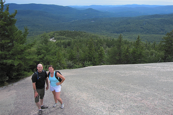
ledges on the Welch-Dickey loop
FAVORITE 52-WITH-A-VIEW PEAKS
Here are the peaks that often considered the finest of the 52 WAV peaks. The views on each of these peaks range from excellent to downright outstanding.
- Black Mountain-Benton
- Cardigan - the best peak in central NH
- Chocorua
- Crawford
- Kearsarge North - the second best firetower on the 52 WAV list list
- Monandock - the best peak in southern NH
- Morgan
- North Baldface - tied for my favorite view on the 52 WAV list
- North Moat - tied for my favorite view on the 52 WAV list
- Percy, North
- Pine
- Roberts - my favorite trailhead on the 52 WAV list
- Roger's Ledge
- Smarts Mountain - the best firetower on the 52 WAV list
- South Baldface
- Sugarloaf-Twin Mountain
- Webster
- Welch & Dickey - the best 52 WAV loop for beginners
- Willard - the best 52 WAV for snowshoeing
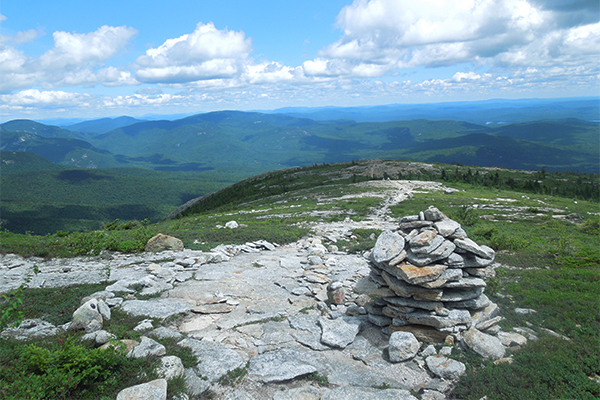
views from near the summit of South Baldface
HOW TO MAKE THE MOST OF HIKING THE 52 WAV
Here are some general tips to help you make the most of your journey to hike the 52 With a View list.
- Cardigan - don't miss additional excellent (and less crowded) views from the South Summit
- Cardigan - rent the AMC High Cabin exclusively for a night or two (capacity=12 in twin bed bunks)
- Cardigan - consider doing the scramble up the very steep (but also very fun) Holt Trail; this is one of the steepest trails in NH
- Chocorua - don't miss additional (and less crowded) views from nearby Middle Sister
- Chocorua - hike all the different routes on this excellent mountain
- Chocorua - hike the Champney Falls Trail after recent rains to see Champney Falls & Pitcher Falls in all their glory
- Chocorua - stay at night at the Jim Liberty Cabin or the shelter at Camp Penacook
- Doublehead - don't miss the good views from behind the cabin and also the excellent views between North & South Doublehead
- Doublehead - make advance reservations to stay in the the USFS cabin below the summit
- Doublehead - in good snow conditions, you can ski or snowboard from the USFS cabin almost all the way back to the trailhead
- Eagle Crag - snag this peak when doing a loop hike of the Baldfaces
- Horn - visit soon because the views are becoming obstructed by fast-growing trees
- Horn - backpack to the tentsites at Unknown Pond
- Horn - combines nicely with a loop hike of both Mt. Cabot (a 4000-footer) and Unknown Pond
- Jennings - combine with Sandwich Dome to grab two 52 WAV peaks in one hike
- Middle Sister - combine with a hike of Mt. Chocorua
- Moat, North - consider a (9.7 mile) traverse of North, Middle & South Moat if you have two vehicles available
- Monandock - hike the lesser-used trails on the mountain (such as the Pumpelly Trail)
- Monadnock - research and discover the secret locations and features of this beloved mountain
- Morgan - take the fork that requires you to climb the ladders
- North Baldface - combine with South Baldface for an outstanding loop; consider also bagging Eagle Crag while up there
- North Baldface - take a dip in Emerald Pool (one of the finest swimming holes in the Northeast)
- North Baldface - stay a night at the Baldface Shelter lean-to
- North Percy - stay a night at the Percy Tentsite
- North Percy - follow a herd path to the summit of South Percy
- Monadnock - climb through the boulder caves near the summit
- Roberts - refer to the Lakes Region Conservation Trust trail map (which can be hard to find) to see the various loop options available here
- Roberts - make sure to take all the spur trails to catch the best views
- Sandwich Dome - don't miss the great views from nearby Jennings Peak
- Shaw - in addition to the trails seen on the Lakes Region Conservation Trust trail map (which can be hard to find), there are other popular hiking trails that are not shown
- Smarts - climb to the top of the firetower for outstanding views (the tower was reopened in 2016)
- Smarts - stay a night in the Smarts Mountain Shelter
- South Baldface - take a dip in Emerald Pool (one of the finest swimming holes in the Northeast)
- South Baldface - stay a night at the Baldface Shelter lean-to
- South Baldface - combine with North Baldface for an outstanding loop
- Starr King - hike an additional 1.0 mile (one way) to Mt. Waumbek and then check out the great views 0.1 mile past its summit
- Success - go off-trail to find the remains of a 1954 aircraft crash about 0.3 mile below the summit
- Sugarloaf-Twin Mountain - don't miss the awesome views from both Middle and North Sugarloaf
- Webster - the most scenic route to the peak is via the Webster Cliff Trail from the south
- Webster - combine with a trip to Mt. Jackson and/or Mt. Pierce (these are two of the NH 4,000-footers)
- Willard - this is an outstanding beginner/intermediate snowshoe hike
- Willard - go off-trail to find a secret waterfall
Do you have any other tips on hiking the 52 WAV that you would like to share with everyone? Please email your tips to gparsons66@hotmail.com or leave a Facebook comment at the bottom of this page.
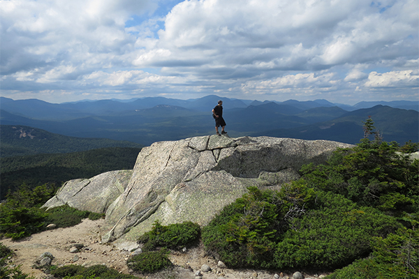
views north from Middle Sister
EASIEST 52 WAV PEAKS
Here are the easist peaks to climb on the 52 With a View list.
- Black (Benton)
- Cardigan (from the west side)
- Kearsarge
- Magalloway
- Pemigewasset
- Sugarloaf (Twin Mountain)
- Willard
Of all these peaks, Willard is probably the easiest overall 52 WAV hike. Magalloway is very short, but is steep and requires one heck of a long drive for most hikers.
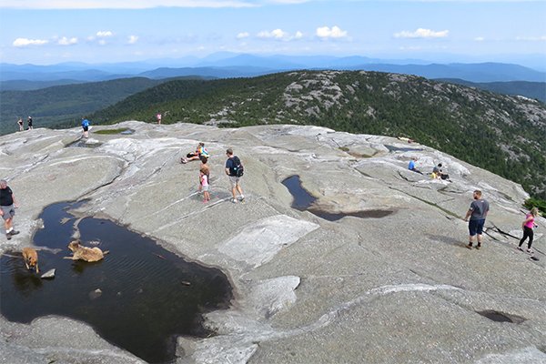
Mt. Cardigan's summit
BACKPACKING THE 52 WAV LIST
Here are all known official backpacking opportunities on the 52 With A View hiking list. Keep in mind that you can also camp pretty much anywhere you want in the White Mountain National Forest so long as you follow strict rules (i.e. a certain number of feet from the trail, from water sources, etc.) and also use LNT principles. The list below simply represents the established shelters and tent-sites:
- Baldface, North - Baldface Shelter (off the southern leg of the Baldface Circle Trail)
- Baldface, South - Baldface Shelter (off the southern leg of the Baldface Circle Trail)
- Cardigan - AMC High Cabin (reservations are required; rented exclusively; sleeps 12)
- Cardigan - Crag Shelter (off the Mowglis Trail)
- Chocorua - Jim Liberty Cabin (off the Liberty Trail)
- Chocorua - Penacook Cabin (off the Piper Trail)
- Cube - Hexacube Shelter (off the Kodak Trail)
- Doublehead, North - Doublehead Cabin (reservations are required; rented exclusively)
- Eagle Crag - Baldface Shelter (off the southern leg of the Baldface Circle Trail)
- Eastman - Baldface Shelter (off the southern leg of the Baldface Circle Trail)
- Horn - Unknown Pond Tentsite (no shelter)
- Imp Face - Imp Shelter & Tentsite (although this is well above the Imp Face)
- Magalloway - Magalloway Cabin (reservations are required; rented exclusively)
- Parker - Mt. Langdon Shelter
- Percy, North - Percy Tentsite (no shelter)
- Roger's Ledge - Roger's Ledge tentsite
- Shelburne Moriah - Rattle River Shelter
- Sister, Middle - Jim Liberty Cabin (off the Liberty Trail)
- Sister, Middle - Penacook Cabin (off the Piper Trail)
- Smarts - Smarts Mountain Shelter & Tentsite
- Stairs - Stairs Mountain Tentsite (no shelter)
- Success - Gentian Pond Shelter & Tentsite
- Success - Carlo Col Shelter & Tentsite
- Webster - AMC Mizpah Hut (reservations are required)
- Webster - Nauman Tentsite (no shelter)
If you are looking for more backpacking opportunities in the state, here is my online guide to backpacking in New Hampshire.
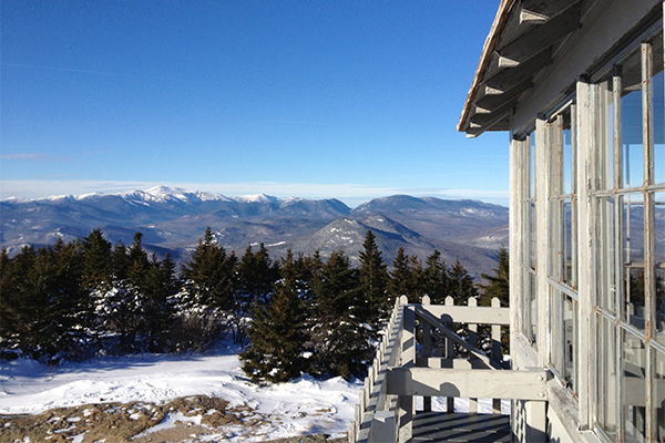
views from the firetower atop Kearsarge North in North Conway
MORE GREAT PEAKS BELOW 4,000 FEET
There are many other great peaks in New Hampshire that are below 4,000 feet in elevation and are NOT currently on the 52 WAV list for one reason or another. Don't miss hiking to the classic views on these peaks and ledges:
- Bald Mountain & Artist Bluff (near northern end of Franconia Notch)
- Boulder Loop (eastern side of the Kancamagus Highway)
- Caribou Mountain (near the northern end of Evans Notch)
- Cathedral Ledge (off West Side Road in North Conway)
- Crawford Cliff (Beans Grant, near Mt. Pierce)
- Lowe's Bald Spot (Pinkham Notch)
- Lucia's Lookout (Goshen)
- Middle Mountain (North Conway)
- Mount Major (Alton Bay)
- North Pack Monandock (Greenfield)
- Peaked Mountain (North Conway)
- Red Hill Firetower (Moultonborough)
- South Pack Monandock (Peterborough)
- Table Rock (Dixville Notch)
- West Rattlesnake (Squam Lake area)
Do you know of any other peaks below 4,000 that should be included in the above list? If you do, please email gparsons66@hotmail.com or leave a Facebook comment at the bottom of this page.
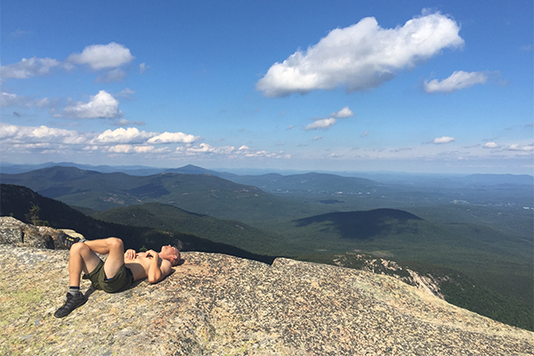
summit of Mt. Chocorua
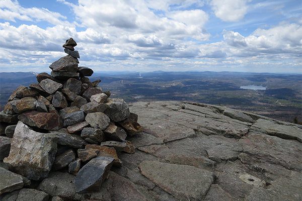
summit of Kearsarge (South)
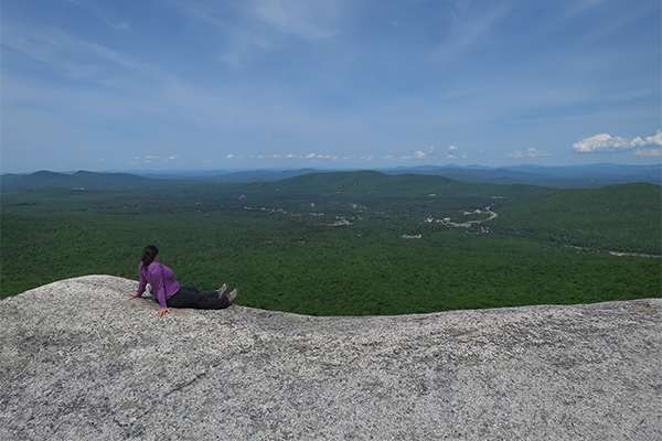
views from the ledges on Middle Sugarloaf in Twin Mountain
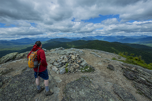
summit of North Moat Mountain
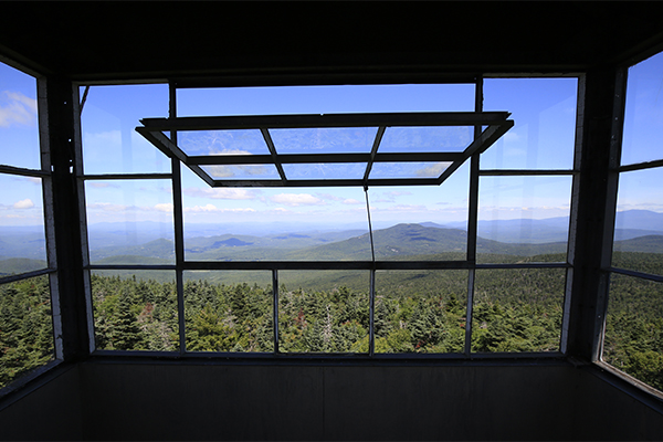
view from the Smarts Mountain firetower
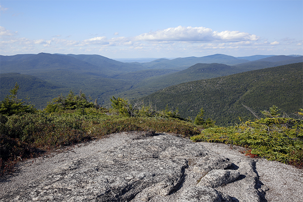
some of the views from North Percy Peak
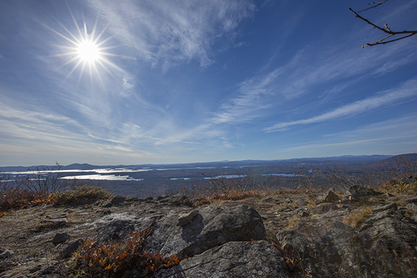
views along the Mt. Roberts Trail on Mt. Roberts (1.3 miles from parking area)
HELPFUL LINKS
Here are some helpful links covering the 52 WAV:
- 52 WAV Map = link
- 52 WAV Trip Reports = link
- 52 WAV Photos = link
- 52 WAV Trail Conditions = link
- 52 WAV Printable Checklist = link
- 52 WAV Group on Facebook = link
- Over The Hill Hikers = link
|


