
BEST RAIL TRAILS OF MASSACHUSETTS |
| RAIL TRAIL / BIKE PATH | TOWNS/CITIES (listed in order of north>south or west>east) | MILEAGE (one-way) |
IS THE TRAIL CONTINUOUS or FRAGMENTED? | SURFACE TYPE | DESCRIPTION / NOTES |
|---|---|---|---|---|---|
| ASHUWILLTICOOK RAIL TRAIL | Adams Cheshire Lanesborough |
11.2 miles | continuous | 100% paved (asphalt) | this beautiful trail runs parallel to MA 8; the southern end of the trail begins at the entrance to the Berkshire Mall |
CENTRAL MASSACHUSETTS
Here is a list of rail trails in central Massachusetts. This includes areas around both Worcester and Springfield.
| RAIL TRAIL / BIKE PATH | TOWNS/CITIES (listed in order of north>south or west>east) | MILEAGE (one-way) |
IS THE TRAIL CONTINUOUS or FRAGMENTED? | SURFACE TYPE | DESCRIPTION / NOTES |
|---|---|---|---|---|---|
| ASSABET RIVER RAIL TRAIL | Hudson > Marlborough; Acton > Stow |
10.4 miles | fragmented (two separate sections) | mix of paved and unpaved trails | I believe the Hudson > Marlborough section is 100% paved |
| BLACKSTONE RIVER GREENWAY | Worcester Millbury |
3.0 miles | continuous | 100% paved (asphalt) | trail will eventually link Worcester, MA with Providence, RI |
| CANALSIDE TRAIL | Deerfield Montague |
3.3 miles | continuous (although some on-road riding is required) | 100% paved (asphalt) | crosses the Connecticut River |
| COLUMBIA GREENWAY RAIL TRAIL | Westfield Southwick |
2.0 miles | continuous | 100% paved (asphalt) | connects with the 7-mile long Southwick Rail Trail, which then connects to the Farmington Heritage Trust Rail Trail in Connecticut |
| CONNECTICUT RIVERWALK AND BIKEWAY | Chicopee Springfield Agawam |
5.4 miles | fragmented (several separate sections) | 100% paved (asphalt) | this growing trail has two open segements: a 3.7 mile trail from the Chicopee town line to the South End Bridge in Springfield and a 1.7 mile section in Agawam; read online reviews of this trail before riding it to help you gauge potential safety issues |
| MANHAN RAIL TRAIL | Easthampton | 9.0 miles | continuous (but includes a fork with two sections) |
100% paved (asphalt) | connects with two other rail trails in the town of Northampton: the Francis P. Ryan and Mass Central sections of the Norwoottuck Rail Trail |
| MASS CENTRAL RAIL TRAIL | many different towns (see trail map on traillink.com) | 31.9 miles | fragmented (several separate sections) | 100% unpaved (crushed stone & dirt) | this trail is extremely segmented; see the trail map on www.traillink.com to see all the separate sections of this trail |
| NASHUA RIVER RAIL TRAIL | Nashua (NH) Pepperell Groton Ayer |
12.3 miles | continuous | 100% paved (asphalt) | this is a beautiful trail with minimal road crossings in central Massachusetts |
| NORTH CENTRAL PATHWAY | Winchendon Gardner |
11.4 miles | fragmented (several separate sections) | 100% paved (asphalt) | trail is supposedly tough to follow in places (unconfirmed); as of 2016, there are three separate sections; trail will eventually be extended from 11.4 miles to 16 miles |
| NORWOTTUCK RAIL TRAIL (FRANCIS P. RYAN SECTION) | Florence Northampton |
4.9 miles | continuous | 100% paved (asphalt) | this trail (formerly known as the Northampton Bikeway) connects beautiful Look Park in Florence with downtown Northampton (which is renown for its quirky shops and excellent restaurants); connects with two other rail trails in the town of Northampton: the Mass Central section of the Norwoottuck Rail Trail and the Manhan Rail Trail |
| NORWOTTUCK RAIL TRAIL (MASS CENTRAL SECTION) | Northampton Amherst |
10.0 miles | continuous | 100% paved (asphalt) | connects with two other rail trails in the downtown area of Northampton (which is renown for its quirky shops and excellent restaurants): the Francis P. Ryan section of the Norwoottuck Rail Trail and the Manhan Rail Trail |
| SOUTHWICK RAIL TRAIL | Westfield Southwick Granby (CT) |
7.1 miles | continuous | 100% paved (asphalt) | also connects to the Columbia Greenway Rail Trail and the extensive Farmington Canal Heritage Trail (CT) |
EASTERN MASSACHUSETTS
Here is a list of rail trails in eastern Massachusetts. This includes areas around Boston and Cape Cod.
| RAIL TRAIL / BIKE PATH | TOWNS/CITIES (listed in order of north>south or west>east) | MILEAGE (one-way) |
IS THE TRAIL CONTINUOUS or FRAGMENTED? | SURFACE TYPE | DESCRIPTION / NOTES |
|---|---|---|---|---|---|
| BATTLE ROAD TRAIL | Concord Lincoln Lexington |
4.8 miles | continuous | 100% unpaved (soft crushed gravel & dirt) | follow this historic trail past 1700s-era buildings within Minuteman National Historic Park |
| BEDFORD NARROW-GAUGE RAIL TRAIL | Bedford Billerica |
3.1 miles | continuous | mostly unpaved | connects with the Minuteman Bikeway and Reformatory Branch Trail in Bedford |
| BRUCE FREEMAN RAIL TRAIL | Lowell Chelmsford Westford |
6.8 miles | continuous | 100% paved (asphalt) | includes an urbanish northern section and a more woodsy southern section; plans are in motion to extend the trail further south from Westford to Framingham |
| CAPE COD CANAL BIKEWAY | Buzzards Bay Bourne Sagamore Beach |
13.5 miles | continuous (although one bridge crossing is required) | 100% paved (asphalt) | beautiful ride along a dedicated path on both sides of the Cape Cod Canal; zero shade on this trail; the 13.5 miles includes riding on both sides of the canal, but most people just do 7-miles (each way) on the northern side of the canal |
| CAPE COD RAIL TRAIL | Wellfleet Eastham Orleans Brewster Dennis |
22.0 miles | continuous | 100% paved (asphalt) | this is arguably the finest rail trail in Massachusetts and certainly one of the best in New England; riding this extended distance trail is a Cape Cod tradition; I recommend camping in Nickerson State Park and riding from there |
| CLIPPER CITY RAIL TRAIL | Newburyport | 3.9 mile loop | continuous (although some on-road riding is required) | 100% paved (asphalt) |
3.3 miles of the loop are complete, but you have to ride 0.5 mile on-road to finish the 3.9 mile loop; there are lots of interesting art sculptures along this route and you get to visit downtown Newburyport as well |
| DR. PAUL DUDLEY WHITE BIKE PATH | Watertown Cambridge Boston |
17.1 mile loop | continuous | 100% paved (asphalt) | this trail parallels both sides of Charles River; this is Boston's best and safest bike ride |
| INDEPENDENCE GREENWAY | Peabody | 8.0 miles | fragmented (three separate sections) | two sections are 100% paved (asphalt) and one section is unpaved (hard stone dust) | there are three parts to this trail: (1) the longest and westernmost section is paved and runs from near the junction of Russell Street and Birch Street to Lt. Ross Park in West Peabody; (2) the second section is unpaved and runs from the junction of Lowell Street and US 1 to the Danvers Rail Trail; (3) the third section is paved and runs from Peabody Street to Lahey Clinic at the North Shore Mall; if you combine sections of the Independence Greenway with the Danvers Rail Trail (and other trails that connect to the Danvers Rail Trail), you can construct a 36-mile plus round-trip ride |
| MARBLEHEAD RAIL TRAIL | Salem Marblehead Swampscott |
4.1 miles | continuous (but includes a fork with two separate sections) |
mostly unpaved | if desired, you can take a detour off the trail to visit Devereux Beach; this trail will hopefully connect to the Independence Greenway trail in the future |
| MINUTEMAN BIKEWAY | Bedford Lexington Arlington Cambridge |
10.5 miles | continuous (except for one major but quick road crossing) | 100% paved (asphalt) | this trail is a member of the prestigious Rail-Trail Hall of Fame (one of only 30 trails in the USA as of 2016); you can extend this trail by an additional 4.0 miles round-trip by linking it with the Alewife Linear Park/Somerville Community Path; this trail also connects to the Bedford Narrow-Gauge Rail Trail and Reformatory Branch Trail at its western end in Bedford |
| NEPONSET RIVER GREENWAY | Boston | 5.2 miles | fragmented (several separate sections) | 95% paved (asphalt) | this trail is expected to be expanded up to 10-miles in the future |
| NICKERSON STATE PARK BIKE PATH NETWORK | Brewster | 8.0 miles | continuous | 100% paved (asphalt) | this is a series of 8-miles of interconnected paved trails that wind their way up, down and through the state park (mostly in the woods); connects to the Cape Cod Rail Trail at its northern end; there are outstanding camping opportunities within the park (you can ride from your campsite right to this trail) |
| OLD COLONY RAIL TRAIL | Harwich Chatham |
7.9 miles | continuous (although some on-road riding is required) | 100% paved (asphalt) | this trail stems from the Cape Cod Rail Trail in Harwich and heads east towards and into Chatham |
| PEABODY-DANVERS-WENHAM-TOPSFIELD RAIL TRAIL | Topsfield Wenham Danvers Peabody |
10.0 miles | continuous | 100% unpaved (hard stone dust) | this route includes the following four interconnected rail trails: a portion of Peabody's Independence Greenway off Lowell Street, the Danvers Rail Trail, the Wenham Rail Trail, and the Topsfield Linear Common |
| PHOENIX RAIL TRAIL | Fairhaven Mattapoisett |
3.5 miles | continuous | 100% paved (asphalt) | views of farmlands, cornfields and salt marshes; connects with the Mattapoisett Rail Trail |
| PROVINCE LANDS TRAIL | Provincetown | 7.3 miles | continuous (although the mileage includes some spur trails) | 100% paved (asphalt) | the main loop itself is 5.5 miles, but there are several spur trails that bring the total mileage to 7.3 miles; this trail has some steep hills, sharp curves, and is likely to have sections with some sand on the trail (for these reasons, inline skating is not recommended here) |
| REFORMATORY BRANCH TRAIL | Concord Bedford |
4.5 miles | continuous | 100% unpaved (dirt) | this dirt path connects to the Minuteman Bikeway and the Bedford Narrow-Gauge Rail Trail; passes the Great Meadows National Wildlife Refuge, which offers excellent birding and hiking trails |
| SHINING SEA BIKEWAY | Falmouth Woods Hole |
10.7 miles | continuous | 100% paved (asphalt) | one of several outstanding rail trails on Cape Cod; this trail has expanded in recent years and is now one of the finest rail trails in New England |
| SOUTHWEST CORRIDOR PARK (PIERRE LALLEMENT BIKE PATH) | Jamaica Plain Roxbury Boston |
3.9 miles | continuous | 100% paved (asphalt) | connects with the Arnold Arboretum, which offers more miles of trails; if you want to start the trail from Boston, take the Orange Line to the Back Bay station (the trail begins on Dartmouth Street) |
| UPPER CHARLES TRAIL | Hopkington Milford Braggville Holliston |
11.0 miles | continuous | mix of paved and unpaved trails | this trail is expected to continue growing; trail is paved from Hopkington to Milford and is unpaved (with stone-dust material) from Braggville to Holliston |
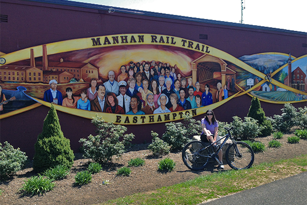
Manhan Rail Trail in Easthampton
TOP TEN RAIL TRAILS IN MASSACHUSETTS
Here are my top ten favorite rail trails in Massachusetts. If you enjoy rail trails, you will undoubtedly enjoy these ones. All of these are 100% paved and continuous. With the exception of the Province Lands Trail, all of these ten trails can be in-line skated.
- BERKSHIRES
- Ashuwillticook Rail Trail
- BOSTON AREA
- Dr. Paul Dudley White Bike Path
- Minuteman Bikeway
- CAPE COD
- Cape Cod Canal Trail
- Cape Cod Rail Trail
- Province Lands Trail (Note: you wil likely find some sand on this trail, so in-line skating is not recommended)
- Shining Sea Bikeway
- CENTRAL MASSACHUSETS
- Columbia Greenway Rail Trail > Southwick Rail Trail with optional extension onto the Farmington Canal Heritage Trail (CT)
- Nashua River Rail Trail
- Norwottuck Rail Trail (Mass Central section) with optional extensions onto the Manhan Rail Trail and/or Norwottuck Rail Trail (Francis P. Ryan section)
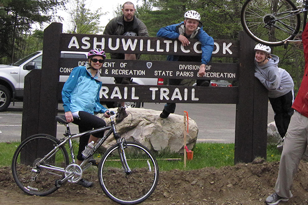
Ashuwillticook Rail Trail in the Berkshires region
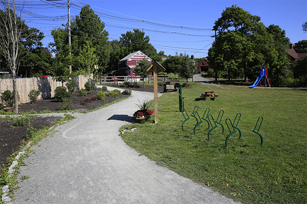
Danvers Rail Trail
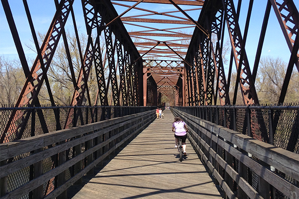
Norwottuck Rail Trail (Mass Central Section)
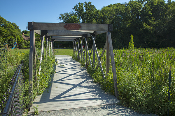
Danvers Rail Trail
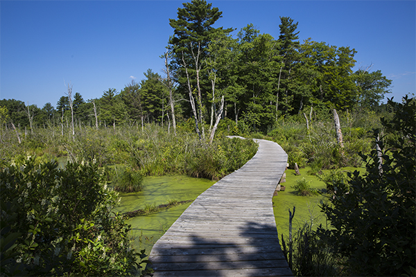
near the start of the Swamp Walk, which connects to the Wenham Rail Trail
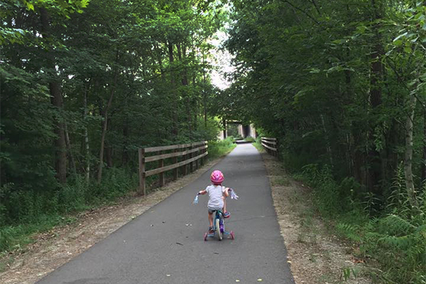
Bruce Freeman Rail Trail, Lowell
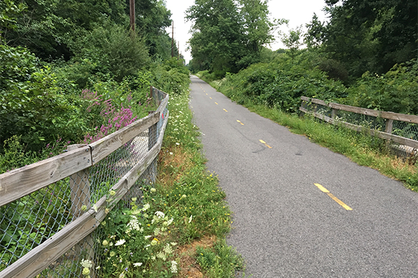
Independence Greenway, Peabody Road to North Shore Mall segment, Peabody
HELPFUL LINKS
Here are some helpful links that relate to rail trails in Massachusetts:
- Rails-to-Trails Conservancy: TrailLink = link
- Massachusetts State Parks: Biking Trails = link
- The best baby bike trailer = link
Connecticut / Maine / Massachusetts / New Hampshire / Rhode Island / Vermont
Home Page / About the Book / Book Updates / Top 40 Waterfalls / Swimming Holes / How To Use This Guide / Contact Us
Waterfall Photography / Top 25 New England Hikes / 4000 Footers of NH / Bigroads.com
© newenglandwaterfalls.com
photographs/images may not be used without permission
| Waterfalls, swimming holes, and hiking can be extremely dangerous. Hundreds of people have been injured or killed in the waterfalls and swimming holes of New England over the years. Never swim in strong water currents. Don't jump into a swimming hole without scouting it first. Do not climb up or along the side of waterfalls. Be wary of slippery rocks. Never swim in pools above waterfalls. Use of this website and all of its information is at your own risk! Newenglandwaterfalls.com will not be held liable for your actions. Be safe out there - and always use common sense! As an Amazon Associates affiliate, this website contains affiliate links. If you choose to purchase any products after clicking any links, I may receive a commission at no extra cost to you. I only endorse products that I have personally used or come highly recommended by trusted peers. |