WATERFALL / DESTINATION NAME
 |
OVERALL
HIKE RATING
 |
TOTAL
DISTANCE
 |
NOTES & HIGHLIGHTS
 |
| Grand Falls, Green Falls & Russell Pond |
 |
20 miles
round-trip |
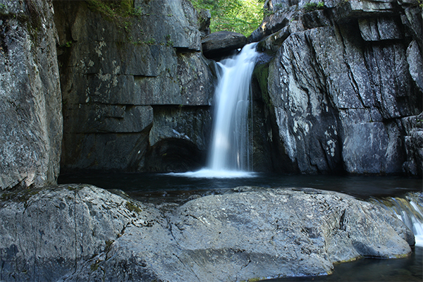
both of these falls are located deep within Baxter State Park; I recommend that you use the Russell Pond backpacking site as a base camp to visit both of these waterfalls; most hikers will start their hike at the Roaring Brook trailhead in the southern end of the state park, but this requires a water crossing that can occasionally be challenging; advance reservations are required and they can be very difficult to obtain as competition is heavy (it helps if you are a state of Maine resident) |
| Gulf Hagas |
 |
8.6 mile
loop |
visiting all the falls within Gulf Hagas makes for an excellent long day hike; many waterfalls and swimming holes are seen along the way; a per-person access fee is charged as this is located on private logging roads; make sure to bring a map (maps are usually available for a few bucks where you pay the access fee); you should also consider taking a detour to also hike to Hay Brook Falls while in the area |
| Katahdin Stream Falls & Katahdin |
 |
11.0 miles
round-trip |
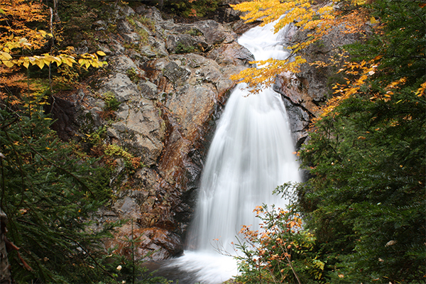
it's 5.5 miles one-way on the final pitch of the Appalachian Trail (referred to as the "Hunt Trail" in this section) to the awesome summit of Katahdin in Baxter State Park; along the journey to the summit, you'll pass Katahdin Stream Falls about 1.6 miles from the trailhead; Katahdin is extremely difficult and should not be attempted in poor weather; a day-use parking permit is required (non-residents of Maine can reserve online on the Baxter State Park Authority website up to two weeks in advance) |
| Kees Falls & Caribou Mountain |
 |
7.0 mile
loop |
this hike visits pretty 25-foot Kees Falls and then climbs to excellent views from ledges on Caribou Mountain; ascend via the Caribou Trail and descend via the Mud Brook Trail; access is via Evans Notch in the eastern White Mountains; this loop hike is one of the great lesser-known loop hikes of the White Mountains |
WATERFALL / DESTINATION NAME
 |
OVERALL
HIKE RATING
 |
TOTAL
DISTANCE
 |
NOTES & HIGHLIGHTS
 |
| Ammonoosuc Ravine & Mt. Monroe and/or Mt. Washington |
 |
10.2 mile
loop |
this loop is widely considered to be the easiest way to climb Mt. Washington, although it is still considered very difficult; along this trip, you'll see Gem Pool, the falls of Ammonoosuc Ravine (assuming you don't miss the short spur trail to see them), and also the AMC Lakes of the Clouds Hut; typically snow free from June through late September, although Mt. Washington can see snow any day of the year (snow in July/August is very rare) |
| Appalachia Waterfalls & Mt. Madison and/or Mt. Adams |
 |
9-14 miles, depending upon route |
there are more than a dozen different ways to climb Mt. Madison and/or Mt. Adams, and there are many different waterfalls depending upon which routes you select; I recommend taking the Brookside Trail on your return trip down Mt. Madison to visit several nice falls; there are also some nice falls off the Amphibrach Trail on the approach to or from Mt. Adams; consult a map to see all your options on climbing these two remarkable above-treeline mountains |
| Beaver Brook Cascades & Mt. Moosilauke |
 |
7.6 miles
round-trip |
there are several tiers of towering waterfalls on the western side of Mt. Moosilauke; all of these falls are visited on the Appalachian Trail; the trail is steep is not recommended when wet; altogether, the falls drop more than 1,000 feet; a backpacking opportunity exists at Beaver Brook Shelter a short distance above the falls |
| Champney Falls & Mt. Chocorua |
 |
7.6 miles
round-trip |
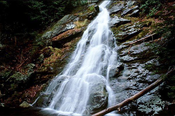
the easiest route up scenic Mt. Chocorua (Champney Falls Trail) includes a short spur loop trail that can take you past seasonal Champney Falls; if you hike in May, odds are the falls will be flowing well; bonus: try to find Pitcher Falls, which dumps into a pretty flume beside Champney Falls |
| Crystal Cascade & Mt. Washington |
 |
8.4 mile
loop |
hikers that are ascending Mt. Washington via the famous Tuckerman Ravine Trail will pass this towering falls; to make a loop, descend the Lions Head Trail; hiking Mt. Washington requires good weather and proper gear (do not attempt before July unless you have extensive snow & ice experience); overnight accommodations are available at the backcountry Hermit Lake shelters, but competition is very high |
| Diana's Baths & North Moat Mountain |
 |
10.2 mile
semi-loop |
this challenging day hike features one of the finest views in the White Mountains and the popular falls and shallow pools of Diana's Baths; take note that parking is extremely limited and you will likely need to arrive before 7:00 or 8:00am to secure a parking spot; return via Red Ridge |
| Dry River Falls |
 |
10.8 miles
round-trip |
located within the Dry River Wilderness; several backcountry campsites are available if you want to camp; some of these campsites are very close to the falls |
| Emerald Pool & the Baldfaces |
 |
9.8 mile
loop |
this is one of the finest loop hikes in all of New England; ascend South Baldface, cross the ridge to North Baldface, and then visit Emerald Pool on your way out; blueberries galore in early August; access via marked trailhead in Evans Notch |
| Falls on The Falling Waters Trail & Mt. Lincoln & Mt. Lafayette |
 |
8.9 mile
loop |
this loop hike (commonly referred to as a the "Franconia Loop") visits three waterfalls and the spectacular summits of Mt. Lafayette and Mt. Lincoln; this loop is typically snow-free from early June through late September; as much of the hike is above-treeline, you must be prepared for the possibility of poor weather; lodging is available at the AMC Greenleaf Hut, which sits a mile or so below the summit of Mt. Lafayette (advance reservations required) |
| Great Falls & Flat Mountain Pond |
 |
9.5 mile
semi-loop |
hike past two sets of small but attractive falls and pools en route to the beautiful backcountry Flat Mountain Pond; overnight shelter and tentsites available near the shores of the pond; hike up via the Bennett Street Trail and return via Flat Mountain Pond Trail |
| Nancy Cascades & Nancy Pond and/or Norcross Pond |
 |
8.6 miles
round-trip |
this recently improved trail visits beautiful cascades and two remote ponds; an optional bushwhack can be taken up to the summit of Mt. Nancy; there are some backpacking sites near the ponds |
| Rattle River Falls & Mt. Moriah |
 |
11.6 miles
round-trip |
hiking the Rattle River Trail (Appalachian Trail) is a an unorthodox but fun way to climb Mt. Moriah, one of NH's 4000-footers; if you have a second car, or you are willing to hitchhike, you can do a traverse of the mountain instead of hiking up and back down the same trail; there is an overnight shelter very close to the falls and pools |
| Thirteen Falls & Franconia Falls |
 |
16.8 miles
round-trip |
this trip, which can be done as a long day hike but is best as an overnight backpacking, visits multiple scenic waterfalls; a wonderful tentsite can be found at the AMC-managed 13 Falls Campsite (fee charged); Thirteen Falls, with its five major sets of waterfalls, is one of the most remote destinations in New England; this trip makes for an excellent introduction to backpacking |
| Weetamoo Falls |
 |
11.5 miles
round-trip |
Weetamoo Falls is deep in the Great Gulf on Mt. Washington; Sphinx Cascades are also nearby; very wild & remote adventure |
| Zealand Falls & Zealand Pond & Zeacliff |
 |
7.8 miles
round-trip |
this hike visits several pretty ponds, a seasonal falls, and excellent views from Zeacliff; you can also hike to nearby Zealand Mountain, one of the 48 4,000-footers of New Hampshire |
| Zealand Falls & Thoreau Falls |
 |
10.0 miles
round-trip |
this family-friendly day-hike visits both of these waterfalls; lodgingis available at the nearby AMC Zealand Falls Hut (advance reservations required); Zealand Falls is best seen in high water (May is usually best); scenic views can be seen from near the hut and also at Thoreau Falls |


